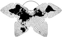
Cahill 1909
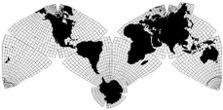
Cahill-Keyes 1975
|
Cahill 1909
|
Go back to
Gene Keyes home page
Cahill-Keyes 1975 |
|
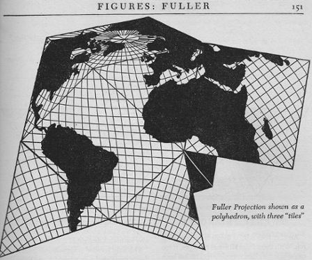
Why Cahill? What about Buckminster Fuller?
Evolution of the Dymaxion Map: An Illustrated Tour and Critique Part 2 by Gene Keyes 2009-06-15 Summary: I
love Bucky, but Cahill's map is a lot better.
Here's how.
CONTENTS Click inside boxes to open other sections in separate windows. |
|
Part 2
1943: The First Dymaxion Map: Cubo-Octahedron with Split Continents Before reprising Buckminster Fuller's map, we
should scotch a couple of widespread myths about it.
• Myth: Fuller's map is the first to show all the continents uninterrupted, with minimal distortion. • Myth: In 1946, the Dymaxion map received the first patent awarded for a map projection. To preface the Dymaxion Map tour, let us go
back to 1934. Cahill has just published
the capstone article of his 35 year effort
to design and improve his Octahedral System of Projection:
“A World Map to End World Maps”. In it he lays down this
challenge:
When finally map and globe practically agree, there can no longer be any substantial variation, and the need of further world mapping comes naturally to an end. . . . Dissent from this view to be effective should indicate another system as good or better. (p. 97; 107)(Perhaps Fuller had never heard of the Butterfly Map, though Cahill had widely circulated and promoted it from 1909 to 1940. In any event, Fuller never took cognizance of the Butterfly octahedral, and certainly never indicated whether his system was "as good or better".) Nine years later in 1943, Cahill is on his deathbed. Buckminster Fuller unveils the Dymaxion world map in Life magazine, March 1, 1943. This one is based on the cubo-octahedron, not his icosahedron of 11 years later.. And it does not yet feature uninterrupted continents. But it made quite a splash, and had a large spread in Life. including four pages of stiff-paper color facets (shown here further below) which could be cut out and assembled into a cubo-octahedron. |
Fig. 2.1: (Article
title, directly above Fig. 2.2 below, but there I am using
a larger photo.) 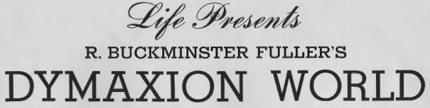
Source: Scanned by Gene Keyes from Life magazine,
1943-03-01, p. 41
|
|
Google Images has recently uploaded
a trove of photographs
from Life, including a set of both published and unpublished
photos of Fuller holding the cubo-octahedron,
but not the color panels of the Dymaxion map, nor any
other pictures of it.
In 1971, I had made some poor-quality photocopies of that 1943 map, in reduced black-and-white, from a bound library volume of Life, and would have had to settle for those on this web-page. But now we are in the Internet age, so I acquired a copy of that Life via eBay, and am reproducing the individual facets and maps further below. Meanwhile, first, herewith the Google-Images. |
|
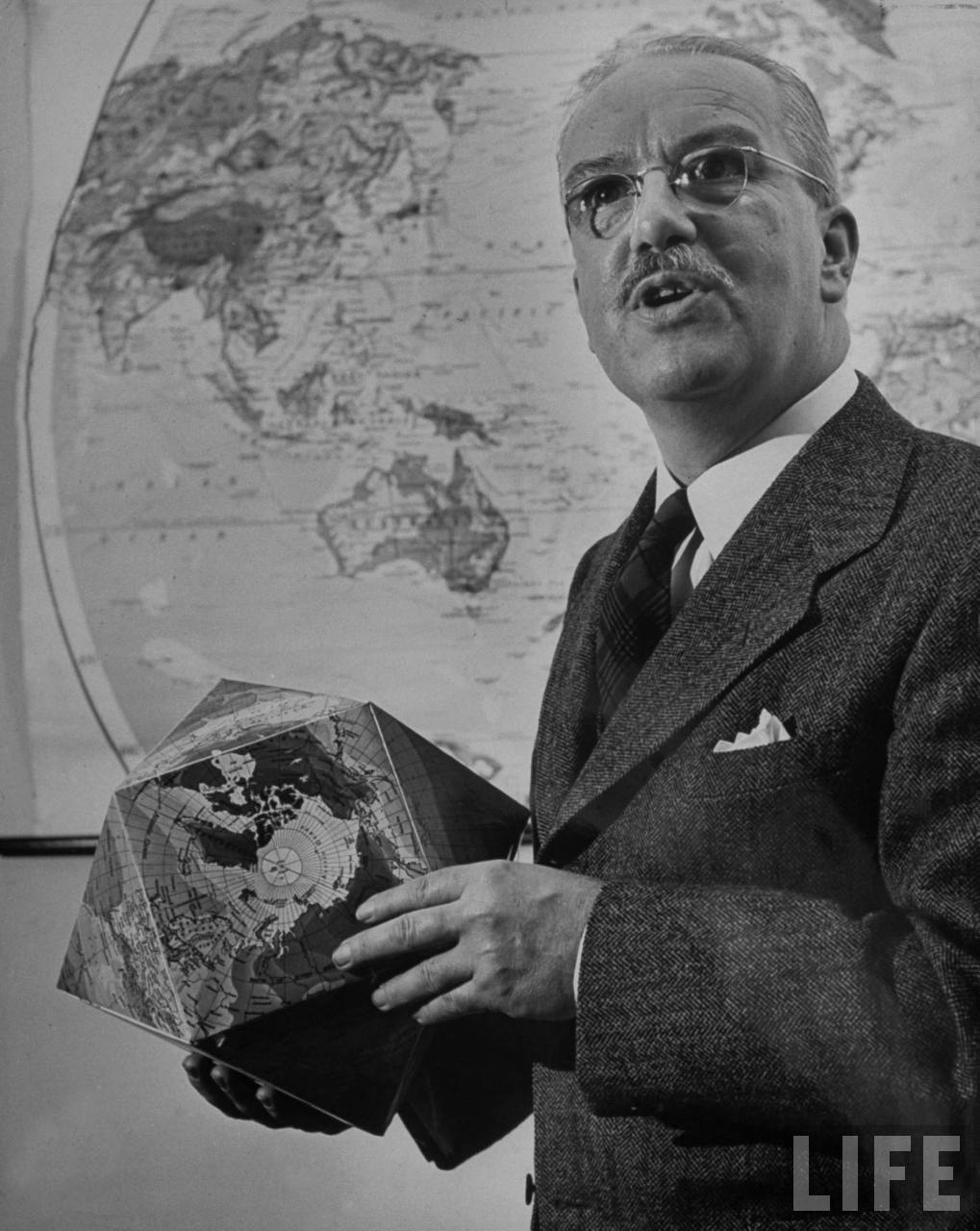
Fig. 2.2 below: Buckminster Fuller
holding the Dymaxion Map folded as a
cubo-octahedron: this was the lead photo in
the March 1, 1943 Life feature, p. 41. (But this Google-Life
picture is much bigger than in the magazine itself.) Notice
that the facing facet is South America, and that the
map is drawn with a 5° graticule in oceans (good), but a
15 x 10° graticule on land areas (not so good).
|
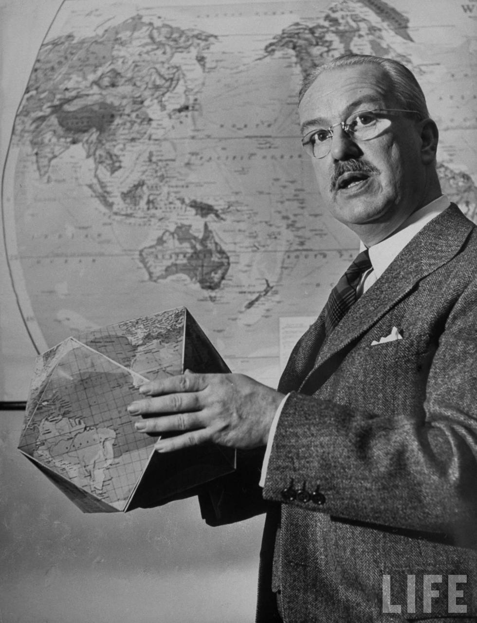
Source: Google Images, http://tbn0.google.com/hosted/images/c?q=cb6dcbb713724163_large Date taken: 1943; photographer: Andreas Feininge |
|
Fig. 2.3 (below): Buckminster Fuller holding
the Dymaxion Map folded as a cubo-octahedron:
photo not included in the Life feature.
Notice that the facing facet is the North Pole, centered
in a square. Unlike these, the 1944 version of the Dymaxion
map had the poles off-center, in order to achieve uninterrupted
continents.
|
|
For a smaller picture size, click in it once; to
restore full size, click in it twice
Source: Google Images, http://tbn0.google.com/hosted/images/c?q=282fdca9b4c6dda4_large Date taken:1943; photographer:Andreas Feininge |
|
Fig. 2.4 below: Another unpublished photo
of Buckminster Fuller holding
the Dymaxion Map folded as a cubo-octahedron. Notice that this
time the upper facet is the South Pole, centered in
a square. Unlike here, as mentiioned, the 1944 version
of the Dymaxion map had the poles off-center, in order
to achieve uninterrupted continents.
|
|
For a smaller picture size, click in it
once; to restore full size, click in it twice.
Source: Google Images, http://tbn0.google.com/hosted/images/c?q=c8de1e08a12c00ae_large Date taken: 1943; photographer: Andreas Feininge |
|
Fig. 2.5 below: We digress for a moment
to recall a very similar photo of B.J.S. Cahill
from sometime in the 1930s. The object he is holding
is a similar artifact made from an equal-area version of
his Butterfly Map, in which the corners of the octants have
been truncated inward, and it can form a mock-globe polyhedron
with eight hexagons and six squares, not Fuller's cubo-octahedron
with eight triangles and six squares. (Life
described Fuller's version as "a cube with its corners cut off";
Cahill's amounts to an octahedron with the corners cut off.)
Personally, I find Cahill's rubber-ball
globe to be more convincing than these
items, but I did make a polyhedron out of my Cahill-Keyes
map. Also, Carlos A. Furuti provides some downloadable neo-Cahill cutouts to make such a model.
(Notice the stained glass windows, with two versions of the Butterfly Map.) |
|
For a smaller picture size, click in it
once; to restore full size, click in it twice.
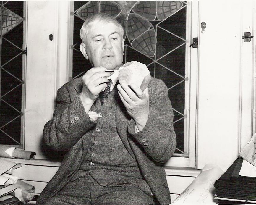
Source: Scanned by Gene Keyes in 2007
from undated duplicate of photo (1930s?) at Bancroft Library, University of California at Berkeley, Bernard Joseph Stanislaus Cahill Papers, (83/39) |
|
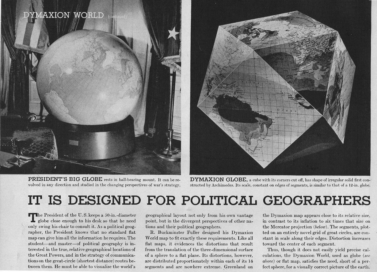
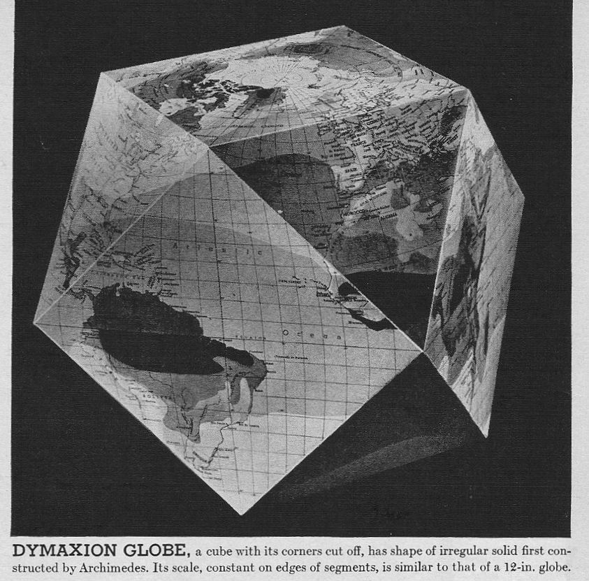
Fig. 2.6 below: As pictured in Life,
Mar. 1, 1943, on right, the Dymaxion cubo-octahedron
equivalent to a 12-inch globe. (At left, President
Franklin Roosevelt's giant 50-inch globe, further
discussed in this web-page's appendix below, and also in Part 9.6.)
While I could find the big Roosevelt globe picture (see appendix below) via Google's Life archive, the adjacent Dymaxion cubo-octahedron itself was unavailable, as were the color spreads and black-and-white pictures of the Dymaxion map.. Apparently, the Fuller map has been withheld from that archive, but not the pictures of Bucky himself. Shame. |
|
Click once to see map at Life's
smaller size; click twice to restore enlarged size.
Source: Scanned by Gene Keyes from Life magazine, 1943-03-01, p. 42, at 177% of original. |
|
Fig. 2.7 below: Cubo-octahedron from Fig.
2.6, but enlarged as if to its 12-inch diameter, 240% of
original (smaller) print size above. (I set the Africa edge to
162 mm, slightly longer than the cut-out facets below, whose edges
are 156 mm. See Notes
on Scaling Dymaxion Maps, Part 8.)
|
Source: Scanned by Gene Keyes from Life magazine, 1943-03-01, p. 42, at 240% of original. |
|
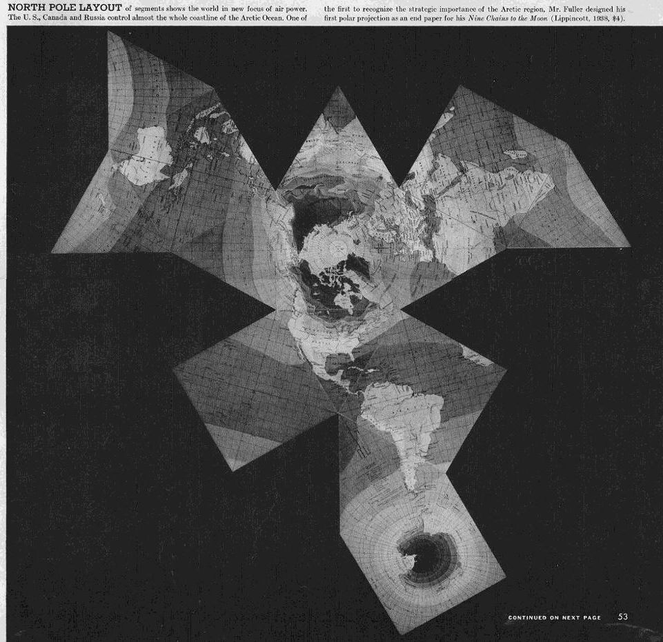
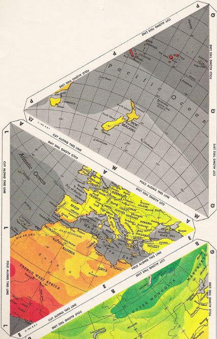
Fig. 2.8 below: And here is one of the
spread-out, broken-continent, early versions of the Dymaxion
map as seen in the 1943-03-01 Life.
The hodge-podge of the design is self-evident: Jagged. Irregular. Split continents. A far cry from Cahill's neatly integrated, whole-continent, whole-earth, symmetrical Butterfly octahedral. (See Part 9.1.) This print was somewhat bigger in the magazine
than the other four. I have enlarged all of them to a scale of
1/100,000,000, with edge lengths of 66 mm. Clicking once below
will reduce the map to Life-size, which has edge lengths
of 48 mm and a scale of 1/139,000,000.
|
|
Click once to see map at Life's
smaller size; click twice to restore enlarged size.
Source: Life Magazine, 1943-03-01, p. 53;
scanned by Gene Keyes;
enlarged to 138% of original, and principal scale of 1/100,000,000. |
|
Fig. 2.9 below: Another of the five
alternate tile arrangements shown in Life, this one captioned
"Mercator World". A fuzzier print of it is seen in Fuller's
1946 Dymaxion map patent: Part 4 herein.
(Note: B.J.S. Cahill had already published various tile assemblies for his octahedral map in 1919, three of which did not break the continents; whereas all of Fuller's do interrupt them. Even Fuller's later versions could show whole-continent profiles in only one of his layout-variants, whereas any other theme breaks the land masses.) Image below enlarged to 178% of original, and scale of 1/100,000,000. |
Click
once to see map at Life's
smaller size; click twice to restore enlarged size.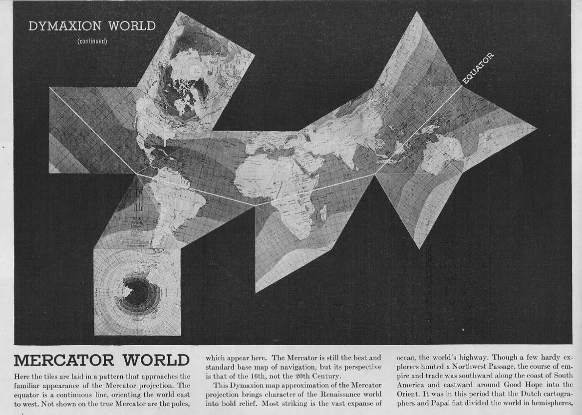
Source: Life Magazine, 1943-03-01, p. 54. Scanned by Gene Keyes; (See also Part 8, Notes on Scaling Dymaxion Maps.) |
|
Fig. 2.10 below: Another of the five broken-mirror
assemblages shown in Life, this one captioned "British
Empire".
Image below enlarged to 178% of original, and scale of 1/100,000,000. |
Click
once to see map at Life's smaller
size; click twice to restore enlarged size.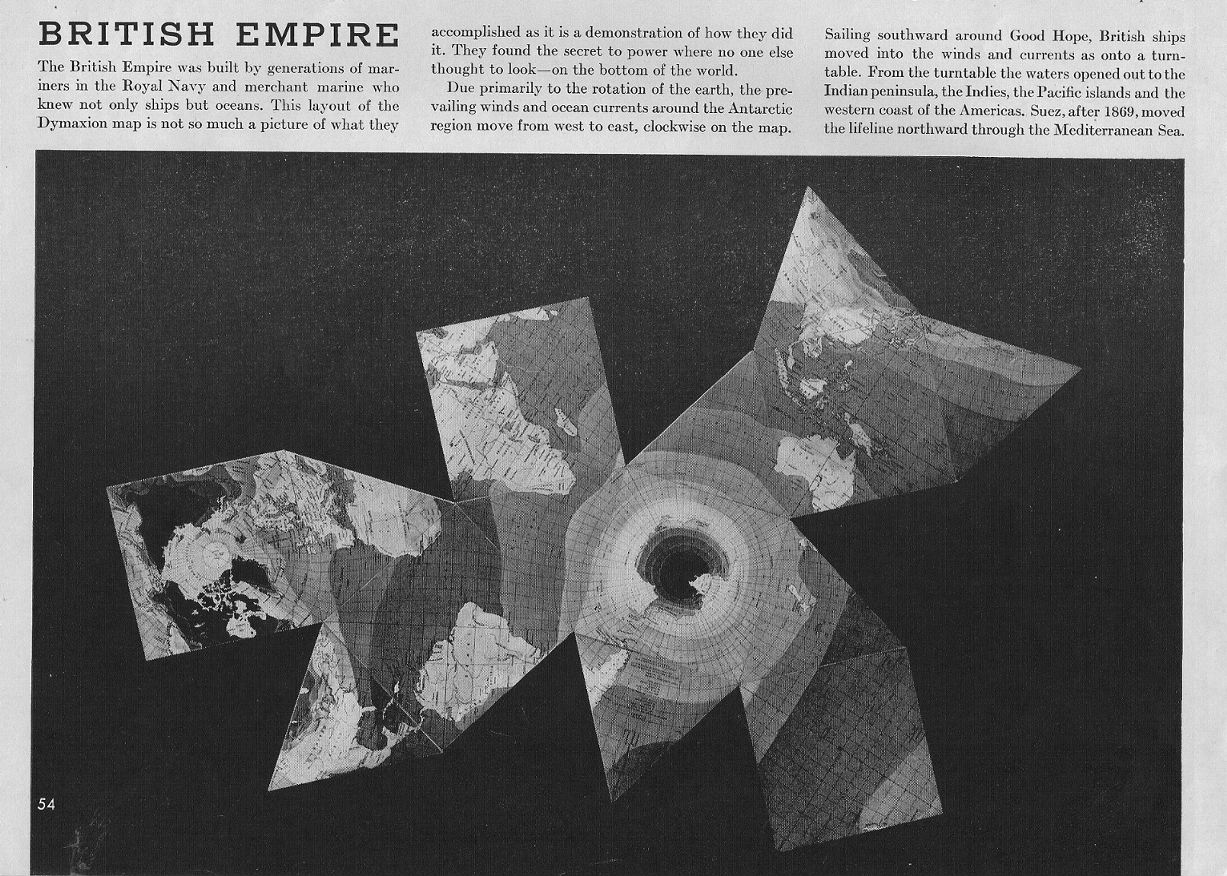
Source: Life Magazine, 1943-03-01, p. 54. Scanned
by Gene Keyes;
|
|
Fig. 2.11 below: This and the next are 1943-wartime
versions of the Dymaxion Image below enlarged to 178% of original, and scale
of 1/100,000,000.
|
Click once to see map at Life's smaller size; click twice to restore enlarged size. 
Source: Life Magazine, 1943-03-01, p. 55. Scanned by Gene Keyes; |
|
Fig. 2.12 below: One more. Image below
enlarged to 178% of original, and scale of 1/100,000,000.
|
Click
once to see map at Life's
smaller size; click twice to restore enlarged size..
Source: Life Magazine, 1943-03-01, p. 55. Scanned by Gene Keyes; |
|
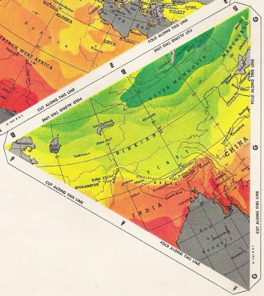
We now move on to the 14 actual color facets in
Life magazine's center-spread. I have scanned these
at their actual size as given, 156 mm per edge, and scale of 1/42,700,000
(as described below).
Meanwhile, there is another point of comparison with Fuller's later versions, whereby this first Dymaxion is better than its successors in a crucial respect. Notice the regular graticule within each facet! While each of Cahill's eight octant graticules are identical to one another, none of the facets in Fuller's later maps have the same net! Indeed, each of them has a unique, irregular, and warped graticule. Here at least, the distribution of meridians and parallels is consistent, e.g., the smooth, curved and evenly-spaced lines in the Atlantic, and Indian Ocean triangles in Fig. 2.13 below. |
| Fig. 2.13 below: Temperature
Scale; Indian Ocean; S. Atlantic Ocean. |
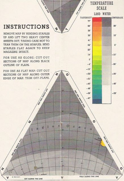
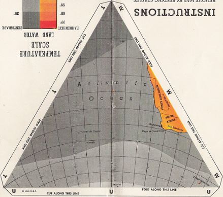
Source: all facets scanned by Gene Keyes from Life
magazine 1943-03-01
center pages at their own size of 156 mm per edge. |
|
Fig. 2.14 below: The square facets
have two different graticules: the polar, and the
equatorial; which, together with the triangles, make
three different graticular facets, versus Cahill's
one. (Fuller's later maps had 14 different graticular
facets; then 22 different ones.)
The North and South Polar squares also underscore my earlier complaint (Fig. 2.2 above) about bad map design: mixing a 5° graticule in oceans (good), with a 15 x 10° graticule on land areas (not so good). In this case, you can see the complete polar net in the Arctic region, but not in Antarctica. (Elsewhere I mention that Cahill's only one degree map suffered from this same stylistic flaw.) Here are the two polars: |
Source: all facets scanned by Gene Keyes from Life
magazine 1943-03-01
center pages at their own size of 156 mm per edge. |
|
Fig. 2.15 below: The Equatorial squares:
|
Source: all facets scanned by Gene Keyes from Life magazine 1943-03-01 center pages at their own size of 156 mm per edge. |
| Fig. 2.16 below: Three
triangles: N. Pacific; N. America; Argentina. (Disregard my
half-triangle redundancy, due to lack of scanner space for oversize
magazine.) |
Source: all facets scanned by Gene Keyes from Life magazine 1943-03-01 center pages at their own size of 156 mm per edge. |
|
Another point of difference between Fuller's
earliest map, and his subsequent ones: the 1943 model has
national boundaries . . .
Now that's fine with me, being a political scientist and writer on war, peace, and world politics. (As Life magazine's subtitle declares on p. 42: "It is designed for political geographers.") Later, Fuller omits borders from all his maps, deprecating politics and nationalism, in favor of whole-earth patterns of climate and energy and population and environment. I'm also good with that, what with me being a pacifist, and Spaceship-Earth-Buckyite, and closet sympathizer of the world government idea. But I have always wanted nice clear borders on my maps, in the course of reviewing all kinds of diplomatic history, and clash of nations, and origins of World Wars I and II, and 2,000 years of China and Russia growing, later bumping into each other, almost at the cost of nuclear war in 1969. A big lack in most of Bucky's recent maps. |
|
Fig. 2.17 below: Last three triangles: S.
Pacific; Europe-Africa; Asia. (Disregard my half-triangle redundancy, due
to lack of scanner space for oversize magazine.)
|
Source: all facets scanned by Gene Keyes from Life magazine 1943-03-01 center pages at their own size of 156 mm per edge. |
|
Fig. 2.18 below: We seem to have an
error of scale in Life's cut-out model: here is an
enlarged detail from Fig. 2.16, showing Scale legend.
|
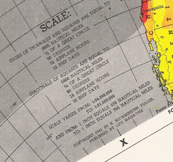
In Part 8, I discuss the difficulties and solutions
of scaling a Dymaxion map; and this one is a case in point. It says the
scale varies from "1/34,200,000 to 1/51,500,000".
The 1/34,200,000 scale is supposed to represent the outer edge of each facet. As will be shown in Part 8, at that scale, the edge should be 195 mm (7 1/2 "). But in fact, the facet edges in the Life center-spread are 156 mm (6"), and therefore at a smaller scale of 1/42,700,000. Life also states that the cubo-octahedron’s scale “is similar to that of a 12-in. globe.” (p. 42) Such a scale is about 1/41,400,000; and that appears fairly close to the 1/42,700,000 edge-scale I calculate for the cut-out pieces. One might suspect that the original artwork for the map assembly was larger than Life, and that the cutouts as printed are smaller than the scale given on them. (There was a similar error on a foldup version of a Honeywell icosahedral map; it listed the same large scale as its much bigger wall-map version. See Part 6.) |
|
Fig. 2.19 below: Fuller's cubo-octahedron
from David Greenhood's book, Down to Earth: Mapping
for Everybody (NY: Holiday House, 1944) 262 p.
(This first edition of Greenhood is bigger and better than
the third.)
|
Source: scanned by Gene Keyes from Greenhood, ibid,
p. 151;
illustration by Ralph Graeter. Reproduced at original book size; scale ca. 1/100,000,000. |
|
Fig. 2.20 below: Three weeks after
the Dymaxion Map debut, Life's issue of March 22,
1943 had this spoof picture of a contortionist
trying to assemble the magazine's folding version. Indeed,
such stiff paper or cardboard models are not easy to put together:
another reason why I think the rubber ball is a better
idea. AllPosters sells a Wallace Kirkland version of this
photo, and a larger online (watermarked) image can be
found at their website.
|

Source: AllPosters, cited above Its medium size image enlarged to 148% by GK |
|
Let us briefly consider two
related matters before moving on to the second edition
of the Dymaxion Map, 1944, in which Fuller achieved the
uninterrupted continents, but at the expense of
badly messing up its graticule.
(1) A 5° graticule;
(2) Irving Fisher's 1943 icosahedral gnomonic map. |
|
Appendix 1:
Importance of a 5° Graticule I comment a lot about how all globes and
maps ought to have at least a 5º graticule, and about how Fuller’s
map started out with a regular 5º degree
graticule, but later versions ruined their regularity,
and so were downgraded to 15º. My position is that
any world map should have
at least a 5º graticule, so as to compare with a 5º
globe at the same scale, and preferably 1º for each. My assertion
is that Cahill’s maps present a far better comparison to such
a globe, than Fuller’s helter-skelter graticule, as will be shown
throughout Part 9.
|
|
Fig. 2.21 below: Now here is what
I mean by a 5º graticule. This 50-inch floor
model is the only globe I have ever seen with 5º geocells.
It was produced under the supervision of Arthur H. Robinson by
the OSS in late 1942 and copies given to President Franklin D. Roosevelt,
and Winston Churchill. Less than 20 were made; restored versions are
at the Library of Congress, and the University of Wisconsin at Milwaukee.
Its scale is 1/10,000,000. (In Parts 9.6 and 9.7-a and 9.7-b, I will
show other photos of this globe, as well as two globes, 12 and 10 inches,
a la Fuller and Cahill respectively, to which I have added an improvisational
5º grid myself.)
Below is the same, but full-size image of the much smaller one published in Life (Fig. 2.6 above). |
|
For a smaller picture size, click in it
once; to restore full size, click in it twice.
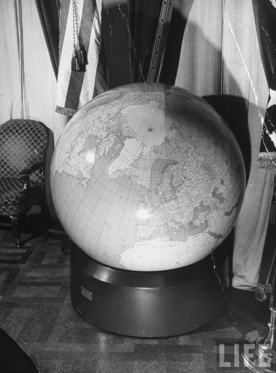
Source: Google Images Life Magazine archive: http://images.google.com/hosted/life Via this search: roosevelt globe (otherwise hard to find) http://tbn0.google.com/hosted/images/c?q=764046a9c4937dfd_large Date taken, 1943; photographer, Thomas D. Mcavoy Original caption: "View of globe in President Franklin D. Roosevelt's office." |
|
Appendix 2:
Irving Fisher's 1943 Gnomonic Icosahedral
Later in 1943,
the prominent economist Irving Fisher published an icosahedral
gnomonic, likewise with the continents all split
up. ("A World Map on a Regular Icosahedron by Gnomonic Projection",
Geographical Review, October 1943, p. 605-619) He
also patented a $10 icosahedral device named "Likaglobe".
which can pull the facets together on a vertical pole.
He subsequently elaborated the projection somewhat, in a 1944
book co-authored with O.M. Miller, World Maps and Globes (NY:
Essential Books, 168 p.).
Fig. 2.22 below is Fisher's icosahedral. It is essentially the same illustration which he used in the October 1943 Geographical Review, except with a pair of extensions for Alaska and Greenland. |
|
For a smaller picture size, click in it
once; to restore full size, click in it twice
Source: scanned by Gene Keyes in 2009-04 from a Xerox of a 1943 promotional flier about the Likaglobe. |
|
This has a 5° graticule,
as maps ought to, but reduced to 15° on
land masses, as maps ought not to. The map also has national
borders.
As it happens, the draftsman in 1943 for Fisher's gnomonic icosahedral was the prominent free-lance cartographer Richard Edes Harrison (1901-1994), who, like Fuller, had been on the staff of [Time-Life's] Fortune magazine, for which he drew some famous wartime orthographic maps. (I had the impression that Harrison was also involved in drafting the Dymaxion map, though on p. 15 of that 1943-03-01 issue, Life credits the Dymaxion map pages "43 through 52 — R. Buckminster Fuller & Life's cartographic staff". Harrison was still a frequent outside contributor to the Time-Life-Fortune group in that period.) In 1976, I interviewed Harrison, who told me that Fuller had opposed the icosahedron, and insisted upon the cartographic virtues of the cubo-octahedron. up until the time he abandoned it eleven years later in favor of the icosahedron. He also told me he saw a telegram to Life on Dec. 25, 1942 from Fuller, which Harrison described as "gibberish", regarding the mathematics of the cubo-octahedron map. If not Harrison, perhaps it was Fisher who also had given Fuller second thoughts about the icosahedron. In retrospect, we can say that Fisher had made a good attempt, but that his design was a poor third to Cahill, and Fuller. Cahill had the unbroken continents on a symnmetrical octahedron. Fisher had a symmetrical icosahedron, but with broken continents. Fuller later reoriented the icosahedron for unbroken continents, but an asymmetrical layout and messed-up graticule. Fisher's 1943 article, and 1944 book, each mention Cahill, in passing, once, but without comment. This annoys and puzzles me no end: neither Fisher, nor Fuller, nor any other cartographic publication, has come to grips with Cahill's achievement. At best, Cahill is barely mentioned, as some kind of also-ran (e.g., by Fisher; 1943 and 1944; as well as books by Erwin Raisz, General Cartography, 1948; and by John Snyder, Flattening the Earth, 1994). Worse, he is simply ignored by those who should know better (e.g., by John Paul Goode, and Buckminster Fuller). Worse yet, when Cahill is mentioned, the illustratrions are tiny and defective. Fisher's 1944 book treats Cahill to a small 15° faint gnomonic — which is not Cahill's principal map — while affording himself three pages of vivid Fisher maps with a 5° graticule. John Snyder's 1994 book has an erroneous re-make of Cahill's less-important gnomonic, split at the wrong meridian. And though Richard Edes Harrison was usually a splendid cartographer, he too botched a re-make of a Cahill gnomonic in a November 1975 Scientific American cover article by Martin Gardner, "Novel Map Projections" (later published in a 1988 Gardner anthology, Time Travel and Other Mathematical Bewilderments). |
|
In 1944, the year Cahill died, and a year after
the Dymaxion map's Life magazine debut, Fuller applied for
a cartography patent, and published a different version, with uninterrupted
continents.
|