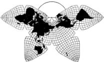
Cahill 1909
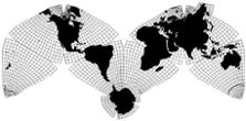
Cahill-Keyes 1975
|
Cahill 1909
|
Go back to Gene Keyes
home page
Cahill-Keyes 1975 |
|
2011-07-01; updated 2011-11-23
Announcing Beta-1 Digital Version:Cahill-Keyes Multi-scale Megamap • with coastlines, and borders; • one-degree graticule; and 40,000 mm grid-length; • at eight scales of 1/1,000,000 through 1/200,000,000; • illustrated by 14 jpegs; and including for free download (see links near end of this page): • 6 very large pdf's plus 13 others; • the entire one-piece 40 MB 1/1,000,000 Megamap file (OOo: OpenOffice.org Draw);
• the 2 programs which drew it, enabling a "Do-it-yourself-Megamap". Designed and calculated by Gene Keyes Programmed by Mary Jo Graça in Perl and OpenOffice.org Draw ©1975, 1980, 2011 by Gene Keyes For fair use, with source credit, by anyone: copy, share, adapt, whatever. (Send me your link!) For commercial use, contact gene.keyes~at~gmail~dot~com |
|
After years of design work by me, and months
of programming by Mary Jo Graça, I am pleased to present here as a
Beta-1 the first complete version of the Cahill-Keyes Multi-scale Megamap at the virtual
and actual scale of 1/1,000,000, or smaller as preferred. Virtual, because
the whole 40 MB file is on a thumb drive as well as downloadable from my website; actual,
because if you have the material and space for it, you can print and assemble
the map as a gym-size showpiece, 40 m x 20 m (132' x 66'). Or various other
scales from large wall maps to smaller notebook size versions.
This Beta-1 Cahill-Keyes Multi-scale Megamap is still at a very early stage, full of deficiencies itemized further on, but comprising six major firsts, unprecedented in any other world map: 1) First-time-ever digital draft of an entire single-frame world map at 1/1,000,000, with 2) a complete one-degree graticule, and 3) proportional geocells throughout, and 4) a three-fold grid spanning 40,000 km, approximate Earth circumference, and 5) scalability from 1/1,000,000 down to 1/200,000,000 or beyond, all with one-degree geocells; and ergo 6) a unitary world map whereby all complete or partial segments, at any size, are scaled replicas of the same parent Megamap, and two additional firsts for the Cahill-Keyes Megamap endeavor: (as in conventional world maps): 7) complete coastlines, and 8) complete international borders. On
the minus side, the Beta-1 as of now has at least seven shortcomings, what
with its early stage, and our limited resources. [I'm still amazed that we
did all this graphic work via the free OpenOffice.org (OOo) 2.0 Draw, on a pair of $300 Asus netbooks with a 4 gig drive and a 7" screen — Mary Jo's, that is; I attached
a 19" monitor to mine. Also, as to be explained later, we upgraded to OOo 3.0 on a $448 Acer notebook at the last minute.]
Negatives: these are all to be dealt with in later Betas:
1) Outdated borders Names, and all other features, are TBA. My aim has always been to produce, as a first step, a simple outline map, with
coastlines and national borders, at 1/1,000,000 and smaller. A “simple” outline
map — but
likewise with high precision and high resolution, global totality and fidelity,
and those all-important one-degree proportional geocells.
For now, this utilizes vector, or line drawn coasts and borders, rather than
a geophysical or remote image composite. I hope others can
add those in the future, and much else to this basic skeleton.
Simultaneously with this development, Joe Roubal at my request and specifications has sent me a custom-made 18", five-degree Cahill-Keyes globe, for close comparison of globe to map; and Todd Ulrich will be printing a first-draft specimen C-K wall map at 1/10,000,000 (4 m x 2 m, or 13' x 6.5': plenty big in its own right, but 10 times smaller in scale than its Megamap parent). I will upload photos of these in the near future. What follows are some indicative screenshots of the Megamap digital version at increasing scales. These are jpegs exported from the OOo original, and re-sized by me to show their "correct" scale on my 19" monitor. But depending on your monitor, these images may not depict the same scale as in its actual file plot, and my 19" monitor (though the kilometer span is constant). Also, they are relatively coarse compared to a pdf or odg print. (An ".odg" is a Draw file from OOo.) Note that the odg and pdf versions (not the jpegs) will print to the precise given size and scale, and show even the smallest one-mm grid-cell, and one-degree geocell, as in Fig. 1, where they are barely visible in the jpeg. The actual heavy-duty odg and pdf files can be downloaded from further below. |
|
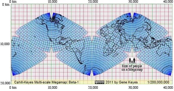
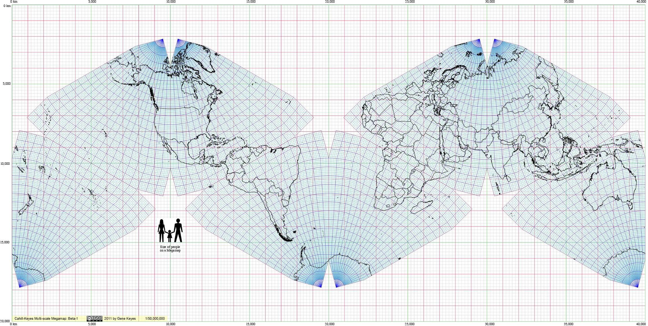
Fig.
1: This is an exact replica of the entire 40 m x 20 m (132' x 66') Megamap at 1/1,000,000,
but directly shrunk to a notebook size of 200 mm x 100 mm (8" x 4"), 1/200,000,000. All Cahill-Keyes world maps have a span of 40,000 km, the circumference of the earth. Sub-Frames from the world map have lesser stated spans, as seen further below. Scale number (e.g., "Scale 1" or "Scale 8", etc.) is part of my "Coherent World Map System". Likewise in the System are a set of frame sizes, (e.g., "Size 1" for 200 mm on a side, or Size 2, for 400 mm, etc.).
Note: In principle, every frame in that System is a square from the Megamap mosaic — except where floor or wall space constraints for the very large whole-earth versions require a rectangular view. Then I use the term "double-square" for this and similar entire-world images here, Normally, in a scaling-up sequence, I would start such a whole-earth rectangle inside a square, with extra graphics of orthographic globes and remote earth images, as in this 1984 prototype. Successive partial views at larger scales then fill the given square. But when it came to doing the digital version, which starts at 1/1,000,000, it was more expedient to use a rectangular "double square", and not waste a lot of empty-grid kilobytes. Thus, Fig. 1 is a "double-square" of Size C, or 100 mm (4") on a side. (Size C would be suitable for paperback books, or magazines: if they still exist in the future; otherwise tablet devices, until rotated to landscape view. My Map System may have to accomodate more "double squares" than I anticipated.) |
|
|
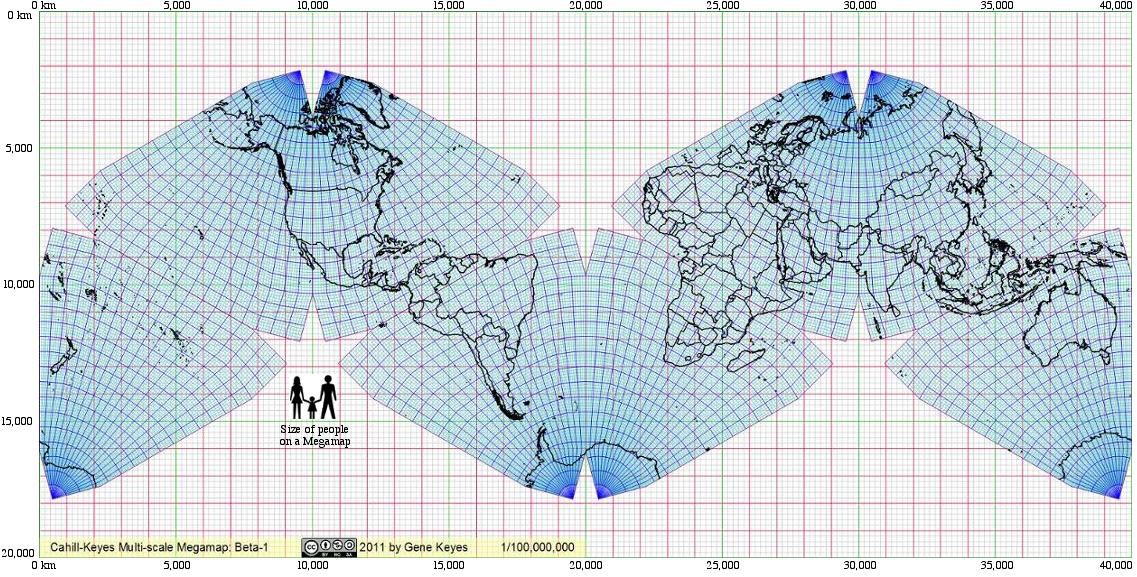
Fig. 2: Below is the same world map, in a frame of 400 mm x
200 mm (16" x 8"), at 1/100,000,000, which represents a view that is twice
the scale as above, and exactly 100 times smaller in scale than the full size parent
Megamap. This mini could be printed, from the pdf files, as two separate
squares, East and West, on letter size paper,
then taped together; see Figs. 12 and 13 below. At Scale 2 and larger, the Megamap juniors
must be printed by installment on ordinary size paper, or sent out to large-media
shops.
Note: Any smaller version of the Megamap is also its floor plan. At this scale, all the bold-line centimeter squares represent one square meter each in the Megamap, (i.e. a little bigger than one square yard each). In other words, since 1 cm = one hundredth of 1 m; and scale 1/100,000,000 = one hundredth of scale 1/1,000,000, thus 1 square cm at 1/100,000,000 = 1 square m at 1/1,000,000. |
|
|
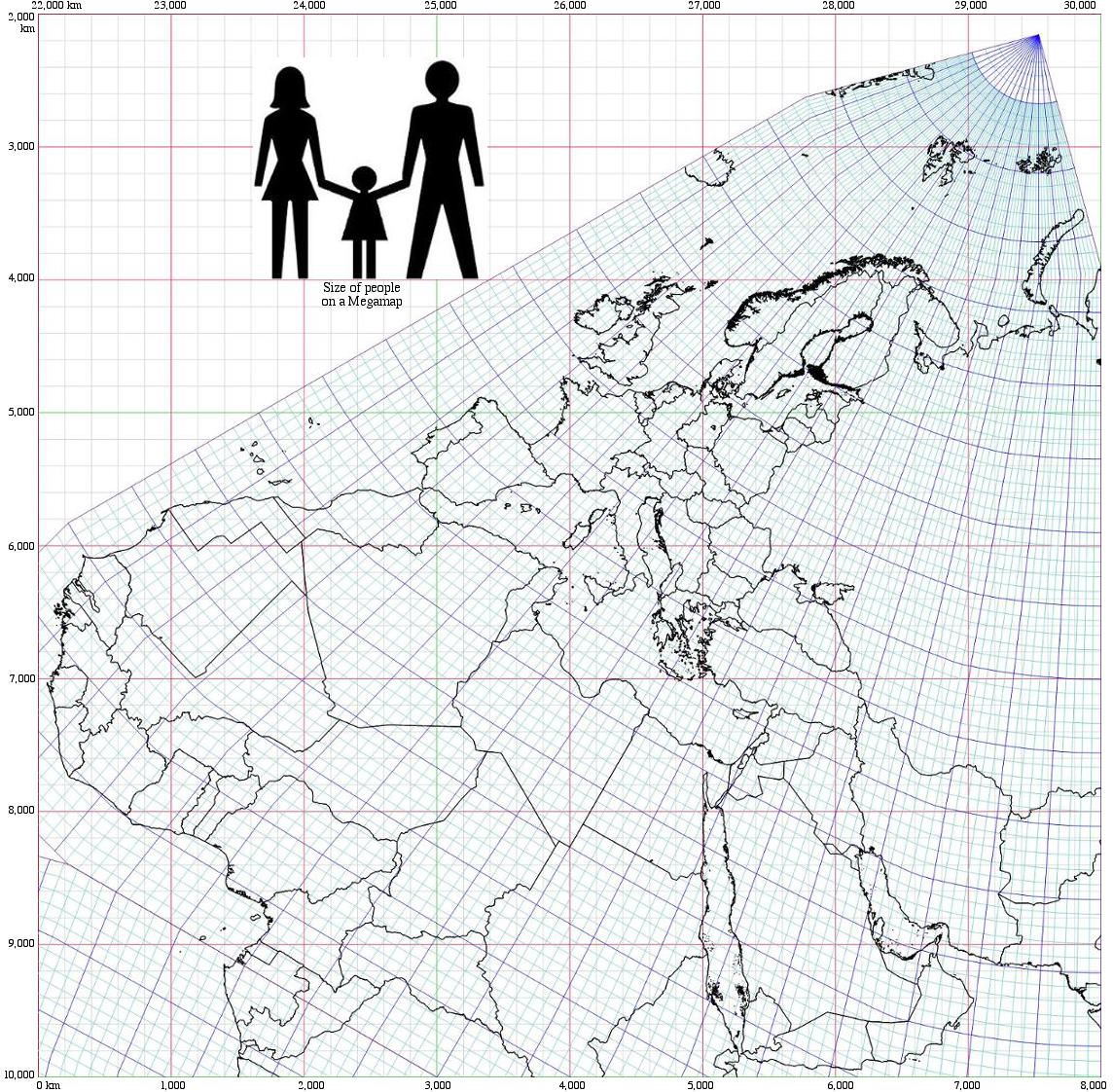
Fig.
3: To show more of the Megamap's scalability, here is the next whole-world version at
1/50,000,000,
in a "double-square" frame 800 mm x 400 mm (32" x 16"), twice the scale of the previous
map. And of course, this is only one-fiftieth the dimensions of the Megamap itself.
But it has the identical content to the 1/1,000,000 parent Megamap, as well
as to both the smaller maps above.
Eight Sub-Frames on letter-size paper are needed to make pdf printouts for a cut-and-tape assembly of this entire map. Further below are downloadable pdf's for the map in one piece, or in eight. |
|
|
Fig.
4.
Here is a 400 mm x 400 mm square extract at Scale 4, or 1/20,000,000, (the scale which I used for my hand-drawn one-degree wall map). At this point it is not worth
using up megabytes and bandwith to put its entire extent on the web page,
and my computers cannot make a jpeg that large anyway. However, you can download, and/or open
a complete 1/20,000,000 12.9 MB pdf on a separate page: click here.
Late update: 2011-06-05: the Google Chrome browser is amazingly faster at rendering pdf files (and moving them without re-drawing), than anything else I’ve seen, including Acrobat. It also shows them onscreen far sharper than elsewhere. Meanwhile, Explorer 8 in Windows 7 won’t even open the pdf, without adjusting a bunch of settings.Of course, you'll have to scroll or pan around to see the whole thing, because it is 2 m x 1 m (78" x 39"). Also, depending on your computer speed, it may take a little while for the pdf to draw in all the coastlines — and re-draw them each time you move the map. [Unless you are using a Chrome browser.] Note: When there is a Sub-Frame like this, not an entire world map, I show the upper-left origin of the segment as kilometer x-y coordinates of the 40,000 km x 20,000 km Megamap Grid. A whole earth Cahill-Keyes map, such as those above, starts at 0, 0. in upper left corner, whereas this one starts at 22000, 2000. That is also how the buttons of the OOo program enable the user to specify the upper-left coordinates (and size) of whatever close-in maps are desired; see Technical Annexes on following web-page. Therefore, the kilometer scale bar atop the map, instead of counting from zero, starts at the x-coordinate within the total Megamap Grid length, and continues in kilometers to the end of the frame. (Likewise vertically.) The scale bar at the bottom of the map shows the same total kilometer span of the frame, but from zero to its end, e.g., 0 — 40,000 km if a whole world map, or 0 — 8,000 km in this case; etc. |
|
|
Fig. 5: The scale below is also 1/20,000,000,
as in the map above, but this is my standard Size 1 frame, 200 mm (8"), whereas
the above frame is Size 2, or 400 mm (16"). For a test sequence, I'm closing
in on the Caribbean.
Note: In principle, segments from the Cahill-Keyes Megamap or from its smaller scale whole-world versions, would be trimmed or bleed-printed to the page edge, without numbers alongside, so that separate maps could be affixed directly to their parent world map, using double-side removable tape, or magnetic media, etc. (See Fig. 2 in this link, of my old hand-drawn prototype.) For example, one could update a wall map, e.g. to show new countries such as Southern Sudan or Montenegro. Or to demonstrate the interchangeability of, say, loose-leaf notebook maps, with their wider source map on the wall. In subsequent Betas, a way would be found to make the km-coordinate numbers optional, at least in hard copy of inner frames, as well as on-or-off layers in an e-version. But the kilometers are too important to omit entirely. |
|
|
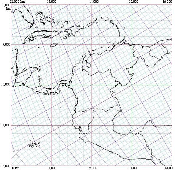
Fig. 6: Now at 1/10,000,000, this excerpt is the scale of content that can be
seen on an oversize wall map version, 4 m x 2 m (6.6' x 3.3'), which will just
barely fit on a hall-wall of my mobile home.
You can view or download a full-size 17.9 MB pdf of the entire 1/10,000,000 world map; click here. [See update note in Fig. 4 above about the vast superiority of the Chrome browser for viewing pdf files.]
Puerto Rico, on the upper 14,000 line, is where my family lived during my teens, 1953-59. Also prominent here are Hispaniola, Venezuela, etc. (See Figs. 3 and 4 in the Technical Annexes, about this how this Sub-Frame is extracted from the 1/10,000,000 scaled-down version of the Megamap.) |
|
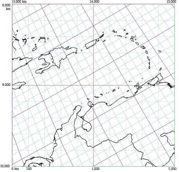
| Fig. 7: Closing in on Puerto Rico and Hispaniola, at 1/5,000,000. |
|
|
Fig. 8: Now, Hispaniola itself at 1/2,000,000,
showing the border between Haiti and the Dominican Republic, where up to 30,000
Haitian civilians were massacred by Trujillo's DR forces in a few days in October 1937.
|
|
|
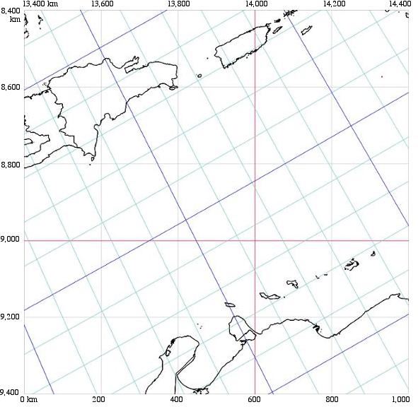
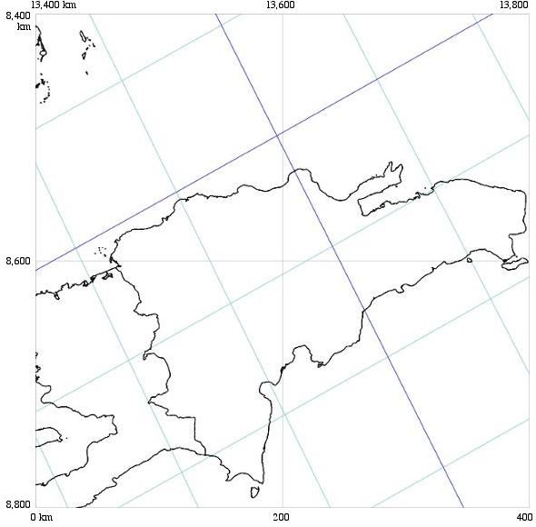
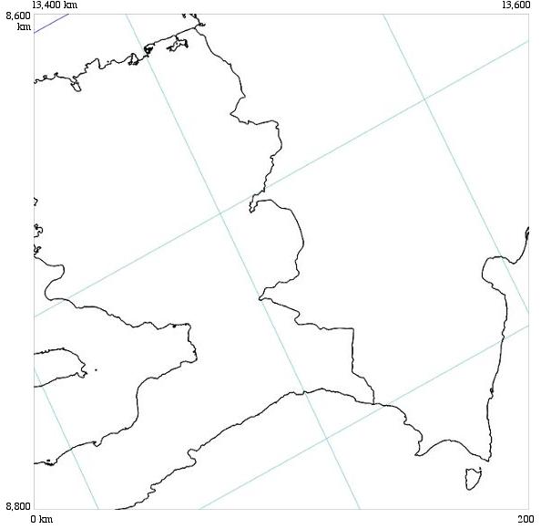
Fig. 9: In general, any map section smaller than the Megamap is by definition
a component of it. Here is a cut-out from the Megamap itself,
showing the Haiti - Dominican Republic border on Hispaniola at 1/1,000,000.
(Compare to corresponding grid square in lower left quadrant in Fig. 8 above.)
This is an example of a square excerpt from the Megamap, extracted by specifying
the upper left km coordinate of the chosen square within the 20,000 km x 40,000
km Cahill-Keyes Grid: in this case, 13,400 — 8,600.
Starting at one mm in a 1/200,000,000 map, the smallest grid-squares in any scale of the Cahill-Keyes map up to 1/1,000,000 represent 200 km on a side. For this 200 mm x 200 mm size of Sub-frame at Megamap scale, we reach all 200 km along a single square. (A new millimeter grid of one km each can now be added here, but is not shown in Fig. 9; see Fig. 10 following.) Note: "200 km" is a semi-precise figure, due to the shrinkage of geocells toward the center of each octant; however, the grid conveys a general sense of proportion within the entire design, layout, and 40,000 km span of the Cahill-Keyes Megamap. The essential criterion of Cahill-Keyes is not equal area or equal distance, but overall fidelity and comparability to any geocell on a globe with at least a five-degree graticule. |
|
|
|
Fig. 10:
A different example of a 1/1,000,000 segment, pre-Beta-1. This is a hand-compiled 400 mm frame of Denmark which I drew in 1976 over
a three-month period. Not a tracing — instead, it is compiled with differential x-y coordinates
for every single point, one at a time. Compare it to Fig. 11 further below, the 2011 digital version, 35 years
later, which plotted the same Cahill-Keyes adjusted coastlines in a matter of hours — after all the programming it took to enable that.
Photos of another hand-drawn example, the Canadian Maritimes, are seen in this link: scroll down to Figs 5, 6, 7 and 8. One is on a wall; a copy is set on a floor within part of the hand-drawn Megamap graticule. Note: In the hand-drawn versions, there is a supervening millimeter grid, wherein one millimeter equals one kilometer: i.e., 1/1,000,000, because there are a million millimeters in a kilometer: QED. In the Beta-1 Megamap I have not yet implemented this sequel grid, but it remains a part of my original plan, because in principle the scales go on increasing, e.g., 1/500,000, 1/200,000 (WVS is good for those), 1/100,000, etc. The millimeter squares likewise expand: to 2, 5, 10, 20, 50 mm etc. My 1994 Metro-Ped bikeway map for the Halifax area of Nova Scotia, at 1/20,000, is an early attempt to align a conventional map as if part of the Megamap grid. (See second paragraph in Metro-Ped.) In that instance, the grid shows 1 kilometer in squares that are enlarged to 50 millimeters: 1/20,000 being 50 times the scale of 1/1,000,000. |
| For a half-size version (i.e., 1/2,000,000), click in map's upper left once. To restore normal size, click twice. 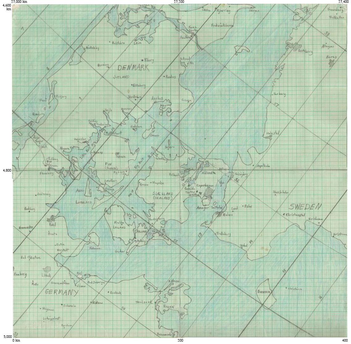
|
|
Fig. 11 And this is a jpeg of the same Denmark segment, from the Beta-1 digital version in 2011 of the
Cahill-Keyes Megamap, extracted in a 400 mm x 400 mm square (16" x 16").
|
|
For a half-size version (i.e., 1/2,000,000), click in map's upper left once. To restore normal size, click twice. 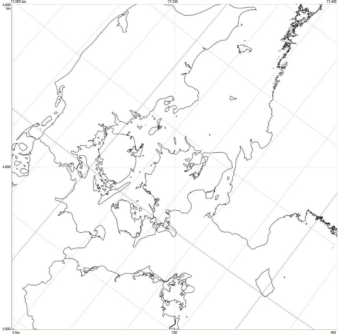
|
|
To conclude the exhibits, here are two more jpegs, at Scale 2 (1/100,000,000), each in a standard frame of 200
mm x 200 mm (8" x 8"), at twice the scale and half the world
of the initial Scale 1 map in Fig. 1 above.
I had already shown the entire Scale 2 map in a double-square frame (Fig. 2 above), but here it is in two halves, New World, and Old, should you wish to print out each part on letter size paper, then tape the two together. To get pdf's for a printable version, click in the Old and New Worlds respectively. Beta-1 pdf's omit the km scale bars and so I have also omitted them from these two jpegs; but future pdf's may well include them. Reminder: pdf makes a much better print than a jpeg. 2nd reminder: see my late-update above about how much faster the Chrome browser renders and moves pdf's. Fig. 12: New World. |
|
|
Fig 13:
And the Old World. To assemble the two halves, print the two pdf's,
trim the left and right margins, and tape the maps together on the underside.
For better results without tiny gaps: before you cut, tape the two halves to each other and
to a window or light table, overlapping their right and left borders (Scotch
removeable tape is nice.) Then use a blade cutter and straightedge along
the adjoining grid line (or scissors, if the halves are well enough affixed
to each other). Then tape the two pefectly matching edges together on the underside.
|
|
|
Here are the very large downloadable files:
A) Some pdf copies, up to 1/10,000,000
B) The original OOo odg at 1/1,000,000 (see further below) |
|
A) Some pdf copies, up to 1/1,000,000:
Downloadable pdf files of the same total Megamap at various scales (All my links open in separate windows.)
Note: Depending on your browser, computer, and monitor, etc., size and clarity of onscreen pdf may be different than printout from the same pdf file. However, the print version is sharp and precise. In general, I don't like pdf as a format because it tends to be slow onscreen, especially for drawing and redrawing the map each time you move it. But the printouts are quite good. Update reprise:
Scale 1 (1/200,000,000), in a frame 200 x 100 mm (8" x 4") 2.9 MB
Scale 2 (1/100,000,000), in a frame 400 x 200 mm (16" x 8") 4.6 MB or 2 installments
(letter size, 8" frame, to print, cut, and tape): Scale 2, New World half, in a frame 200 x 200 mm (8" x 8") 2.3 MB Scale 2, Old World half, in a frame 200 x 200 mm (8" x 8") 2.4 MB Scale 3 (1/50,000,000), in a frame 800 mm x 400 mm (32" x 16") 7.5 MB or 8 installments
(letter size, 8" frame, to print, cut, and tape): (Note: cut line is horizontal, along the central y-10,000 line, instead of the Equator, so each octant exchanges a portion with its north or south neighbor. This makes it easier to cut and tape, than if I did whole octants, which would have to be cut on diagonal Equators.) Octant 1 0.7 MB Octant 2 2.0 MB Octant 3 1.6 MB Octant 4 1.4 MB Octant 5 0.6 MB Octant 6 0.2 MB Octant 7 0.7 MB Octant 8 0.2 MB Scale 4 (1/20,000,000), in a frame 2 m x 1 m (78" x 39") 12.9 MB Scale 5 (1/10,000,000), in a frame 4 m x 2 m (13' x 6.5') 17.9 MB
Four strips, one meter wide by two meters high (39" x 78"),
to facilitate printing and assembly like a billboard; these each have a north-south pair of octants:
Strip 1 (Alaska to New Zealand) 2.1 MB
Strip 2 (Greenland to South America) 6.5 MB Strip 3 (Norway to South Africa) 4.5 MB Strip 4 (Siberia to Australia) 4.6 MB
|
|
B) The original OOo odg at 1/1,000,000:
1) Full size Cahill-Keyes Megamap itself: the downloadable parent file, already plotted, with WVS coastlines and borders, 1/1,000,000 Item #1 above is the largest of the Megamap files;
and is also the source of identical but smaller replicas in seven separate
files (Which I have not uploaded here, except for five smaller pdf's, but
the other odg's can be made yourself, or are available free upon request, gene.keyes at gmail dot com.) The
full 1/1,000,000 file cannot be seen in its entirety onscreen, because it
can only be reduced to 5% by OpenOffice.org Draw, still too large, unless
you have a stupendous monitor. However, the Megamap has a five-button set to enable the whole thing to be visible at smaller scale versions of the same entire file. In this Beta-1 version, the macro-linked buttons are for Main-frame re-sizing (i.e., re-scaling). and Sub-Frame re-sizing, re-location, and extraction. (The buttons don't do the extracting: after you have designated a Sub-Frame, you export it to a jpeg or pdf, besides odg.) These allow for Sub-Frames of the Megamap itself to be shown by specifying the size and upper left km coordinates of the chosen square within the 40,000 km x 20,000 km grid. The extractable Sub-Frame defaults to 200 mm x 200 mm (8" x 8", to fit on letter size paper), but can be re-sized up to 1 m x 1 m (in OOo 2), or 3 m x 3 m (in OOo 3). It can also be a vertical or horizontal rectangle as required. |
|
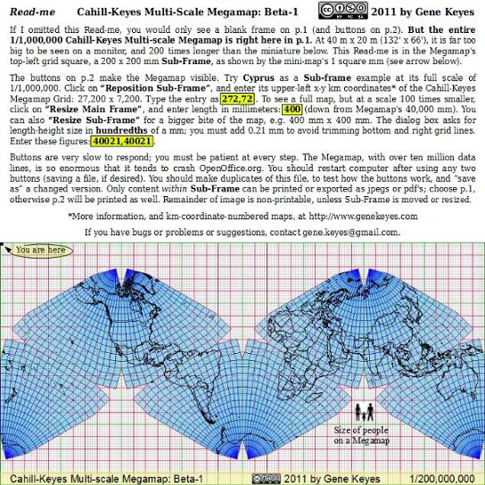
Fig. 14: As a preview and orientation for
the Megamap's magnitude, here is a jpeg of its Read-me, the same jpeg which
appears on the map after it has opened:
|
|
|
— and for the digital do-it-yourselfer —
2) "MegamapMaker-prep": A 985-line executable Perl program to convert standard digital longitude-latitude data to the somewhat compressive Cahill-Keyes x-y coordinates (described in more detail in the Technical Annexes, next page, and also in its earlier form, with only a few coastlines, here). 3) "MegamapMaker-plot": The complementary OOo Draw program, which takes the x-y data (above) and outputs the map itself, either onscreen, or for printing, or export to jpeg's or pdf's, by means of macro-linked buttons for plotting, resizing, etc. Likewise described more fully in the Technical Annexes.Both programs are in this downloadable zip file. (324 KB. expanded.) |
| ^ * From 1928 paper published 1929; citation in first of two pdf's, p. 129. (This is the second.) |
| Go to p. 2, Megamap Technical Annexes |