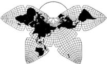
Cahill 1909
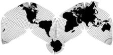
Cahill-Keyes 1975
|
Cahill 1909
|
Go back to Gene Keyes
home page
Cahill-Keyes 1975 |
|
Large test prints and corresponding globe with 5° geocells
This Web-page is a notebook of rough drafts, not ready for prime time, but indicative of considerable recent progress on physical specimens, and of my aim for further development of the Cahill-Keyes map and globe combination. Below are photographs of very large test prints from pdf files at the above link, as produced on vinyl by Todd Ulrich. Also shown are some comparison shots of a 5° geocell Cahill-Keyes globe, divided into the same octants as its counterpart map: made to my specifications by Joe Roubal. As with the map itself, the globe is still only a preliminary test version. The first images below are of a 5' x 10' junior Megamap — among the biggest single-piece world maps in existence, and the only such one printed with a resolution of one-degree geocells. It is 1/13,000,000: about as big as Cahill's own largest draft, which was in eight pieces, and 15° resolution. (But due to printer limitation, this is not one of my "System" scales, e.g., 1/10,000,000, which would be 6 1/2' x 13', i.e., 2 m x 4 m.) |
|
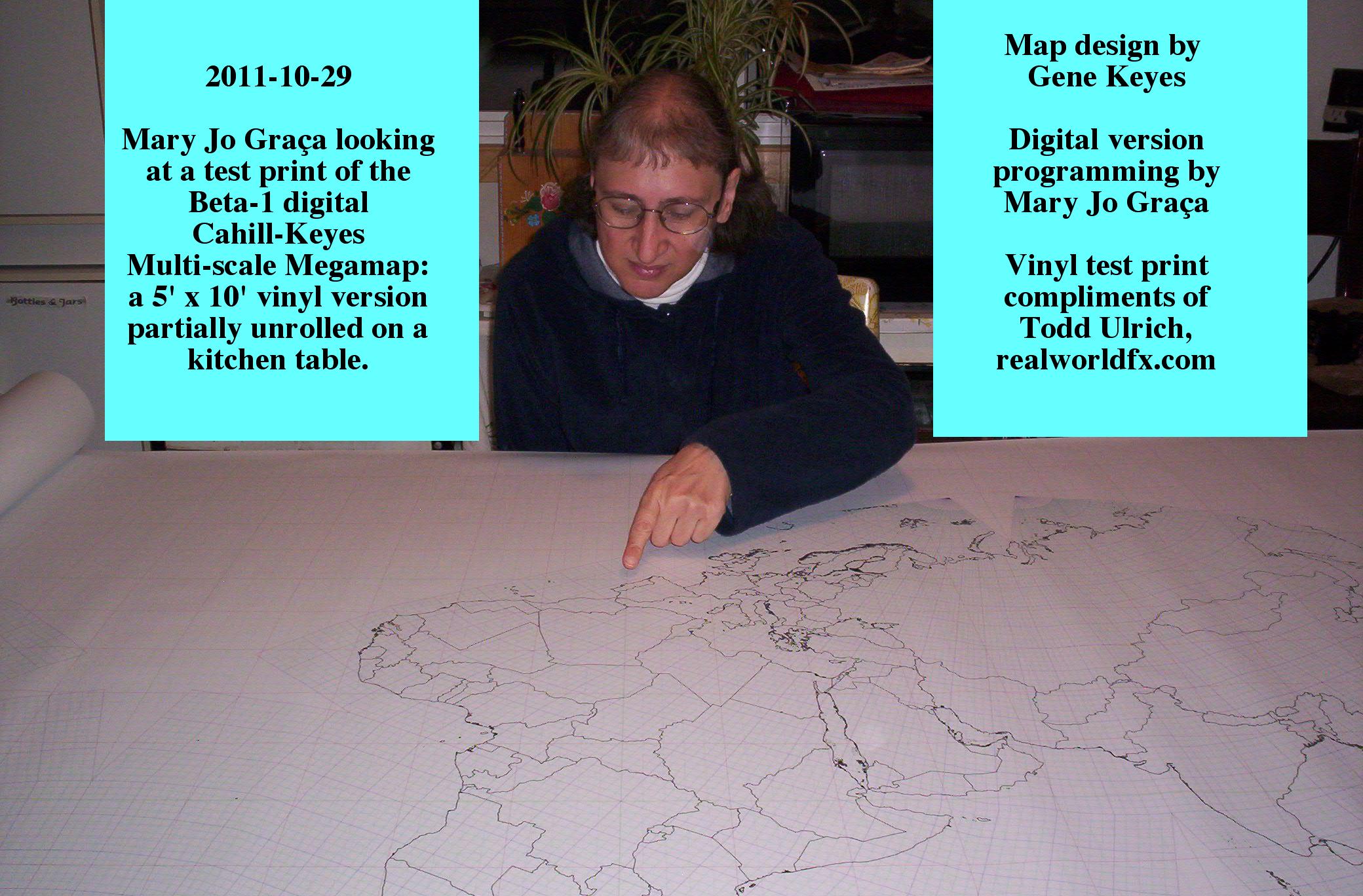
Fig. 1. Partial
view, Old World sector of Cahill-Keyes (junior-size) Megamap, scale 1/13,000,000,
on a kitchen table, with Mary Jo Graça pointing to her native Portugal.
|
|
For
a half-size image click in it once
at upper left; to restore full size, click in
it twice.
|
|
Fig. 2. At
this writing we have not yet cleared enough wall space to post the map (in our mobile home jammed with books), so here
Mary Jo and I are unrolling it to show first the New World...
|
For
a half-size image click in it once
at upper left; to restore full size, click in
it twice.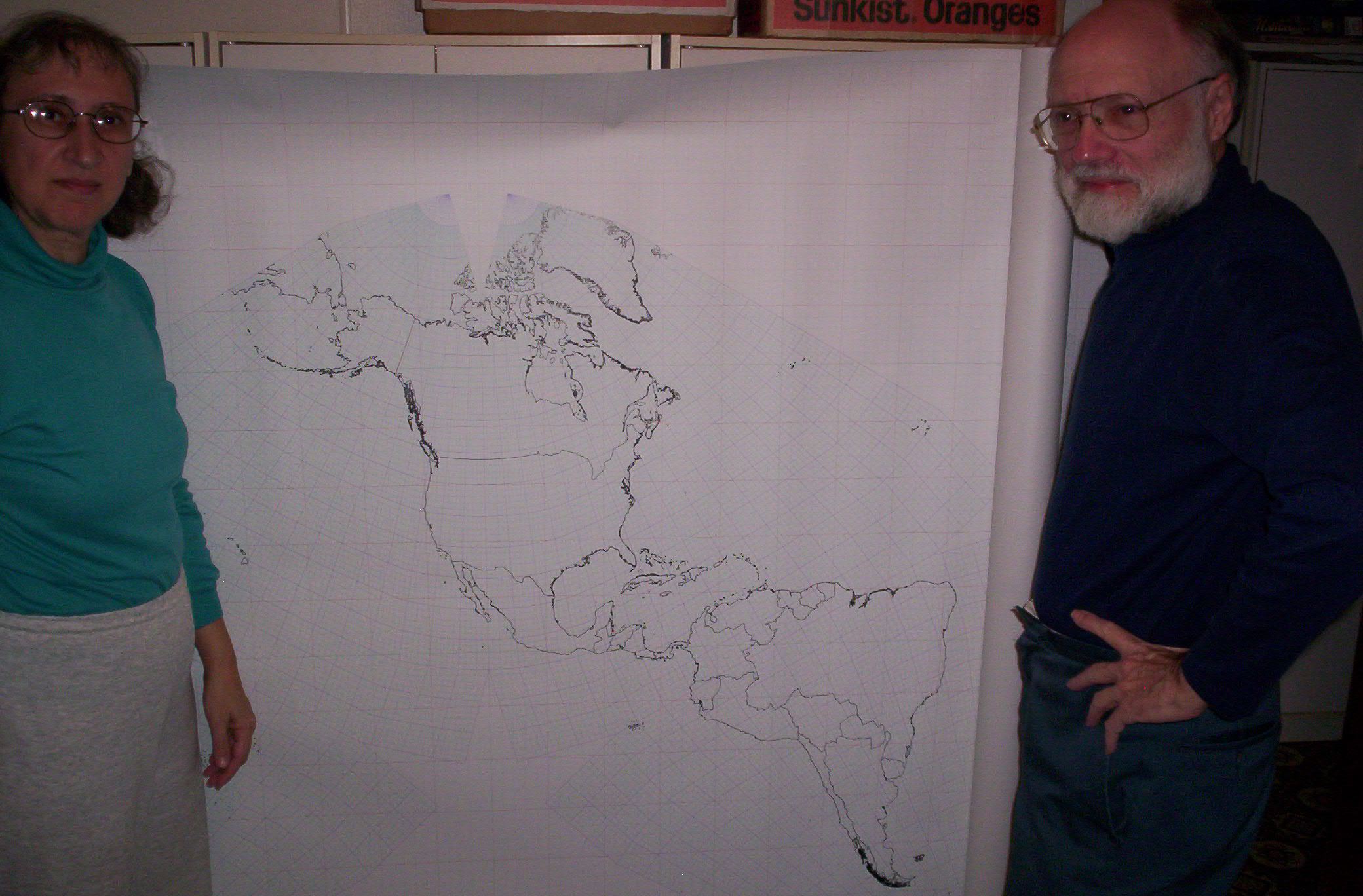
|
| Fig. 3. ...then the Old World. |
For
a half-size image click in it once
at upper left; to restore full size, click in
it twice.
|
|
Fig. 4. Myself beside a (smaller) partial print by Todd
Ulrich of the digital version at a System scale of 1/20,000,000 (compare older hand-drawn version, 1975-84). I am
also holding a provisional prototype of the 5° geocell globe, made to
my specifications by Joe Roubal in 2011. However, I did not assemble it as a seamless
globe with hidden tape, as the manufacturer had intended. Instead, I made Velcro joints
for the 8 styrofoam octants. They can be dismantled and re-assembled, to
demonstrate the point-for-point comparison between each octant of the Cahill-Keyes
globe, and flat map, respectively. Here we see the dramatic
"real" size of Africa vis-a-vis Europe on the map as on the globe. (Anyway, I've
never considered Europe a continent, but rather, a peninsula, so to speak, on the Eurasian
mainland.)
Note: incomplete test print, left, is at larger System scale of 1/10,000,000; see picture after this one. |
For
a half-size image click in it once
at upper left; to restore full size, click in
it twice.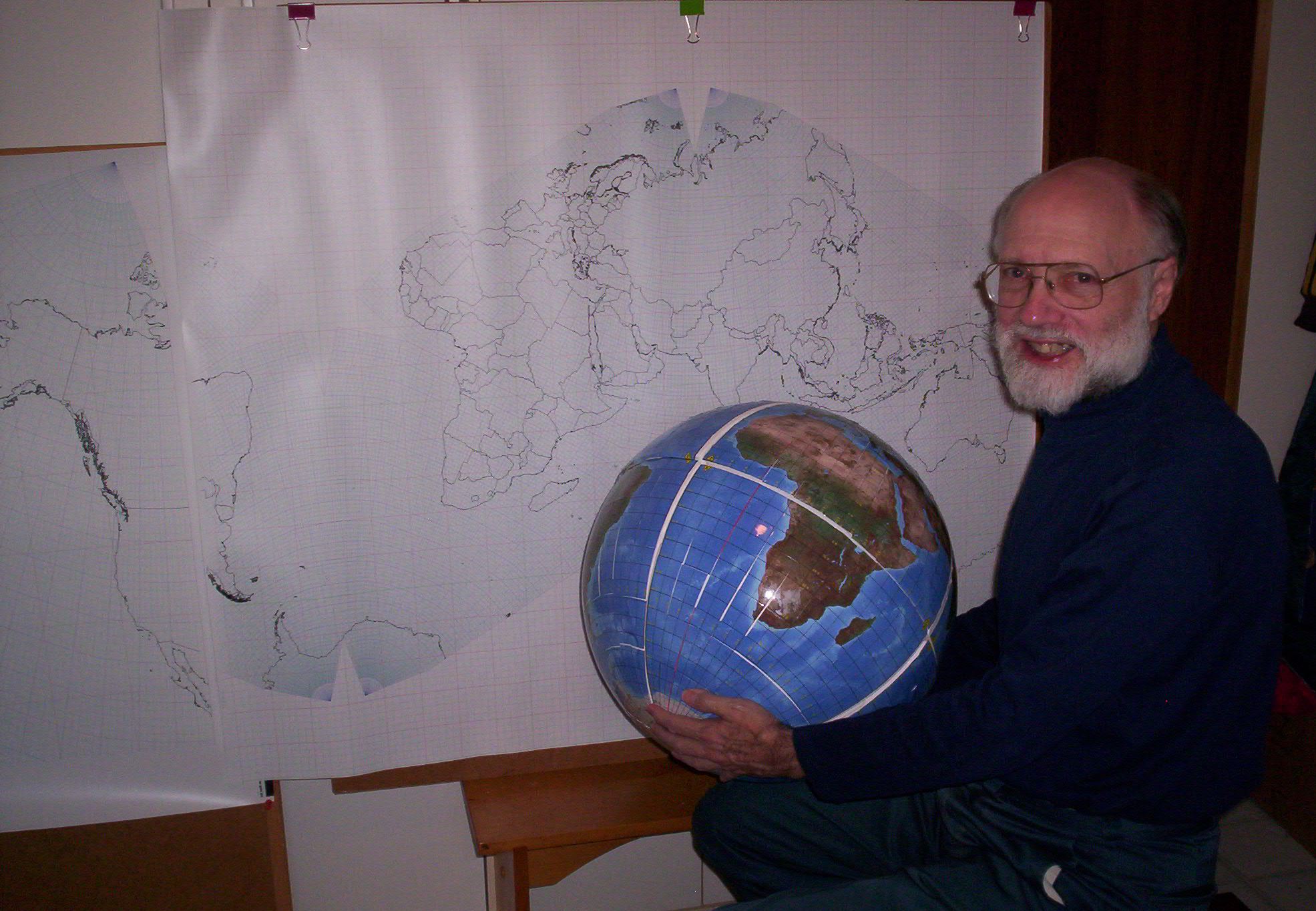
|
|
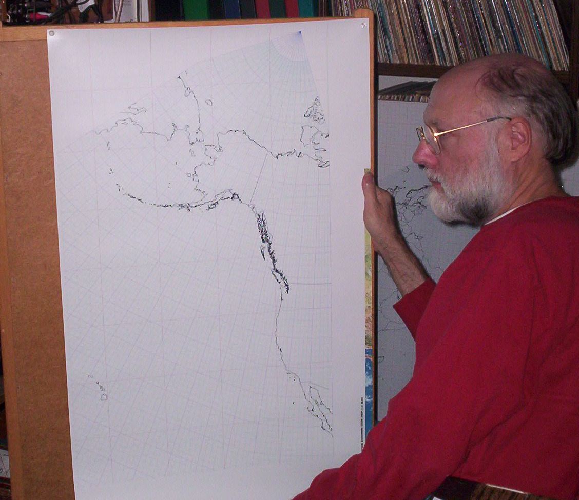
Fig. 5. Below, a different test print, likewise way ahead of my hand-drawn versions, 1975-84.
(Compare 1983 photo, same scale, fig. 4 in this link.) This is a portion of Octant 1 from the Cahill-Keyes map, at 1/10,000,000, as
printed on vinyl by Todd Ulrich, from the pdf file generated by Mary Jo Graça's
programming. (Color strip on right-hand side is irrelevant.)
|
|
|
Fig. 6. This is a partially assembled view of the Cahill-Keyes
globe. Due to circumstances beyond my control (including inadequate
die-cutting, and my mediocre manual dexterity), the vinyl paste-on gores
do not join as well as they should. But this 5° globe is a big step beyond my earlier pencil-drawn 5° improvisation (see figs. 9.6.12 and 9.6.13 in this link).
|
For
a half-size image click in it once
at upper left; to restore full size, click in
it twice.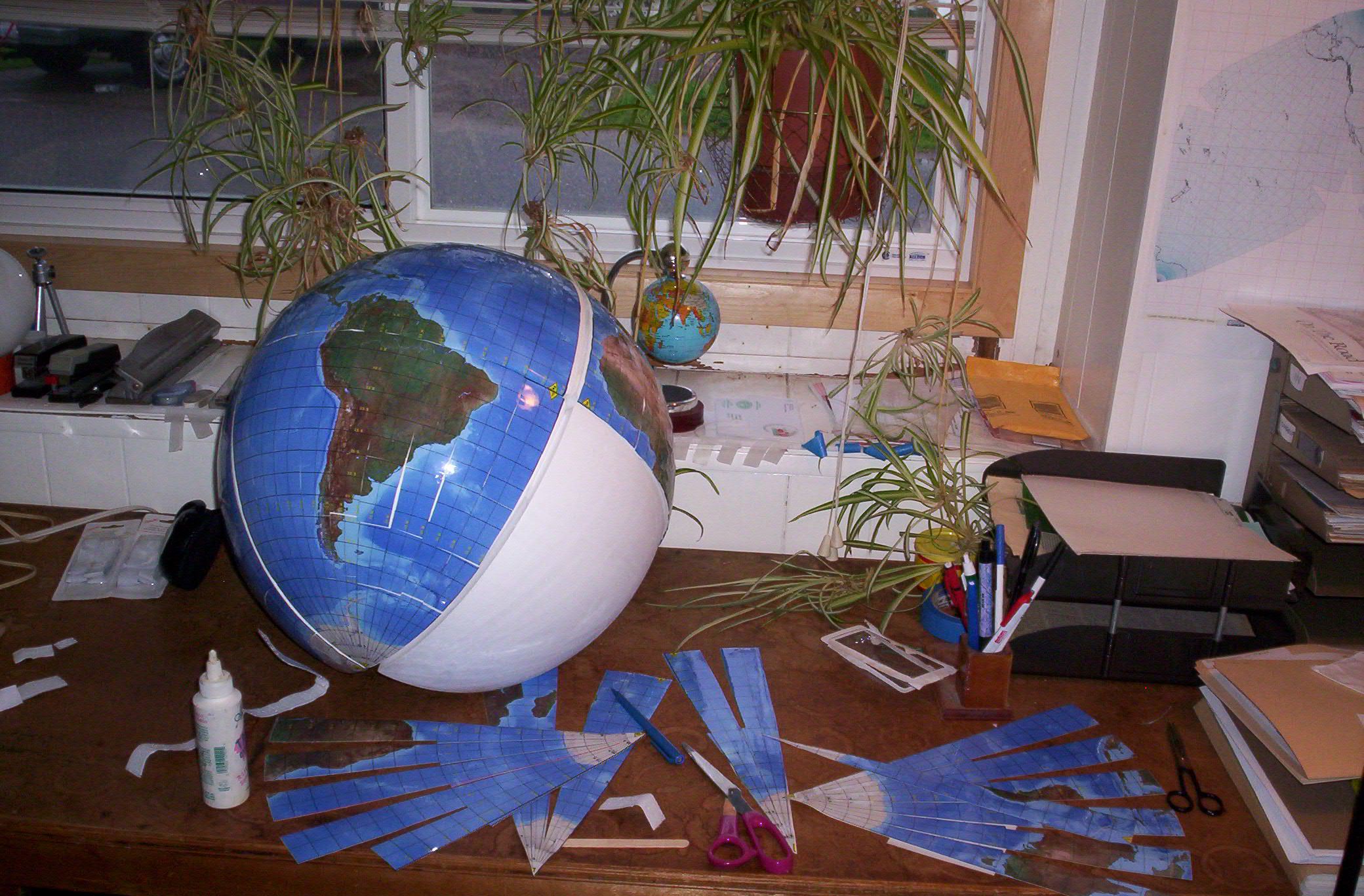
|
|
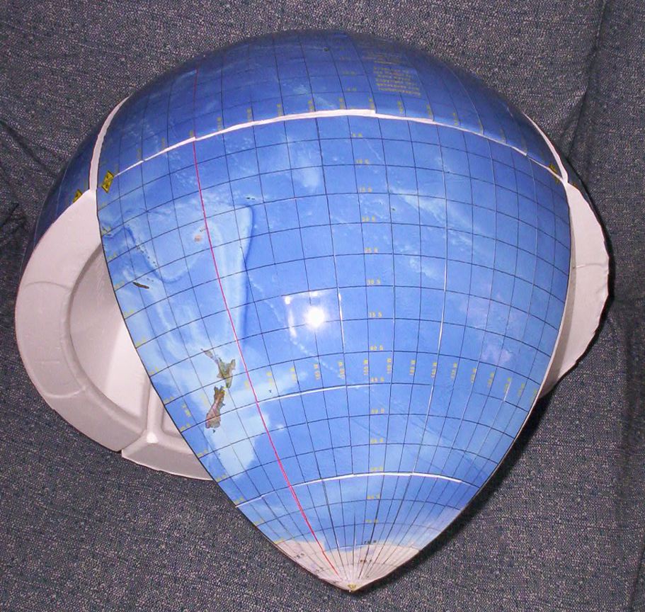
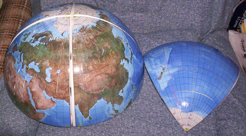
Fig. 7. Here is Octant 6, New Zealand and South Pacific,
in a partially-assembled globe. The styrofoam octants are visible, but not
the Velcro strips.
|
|
|
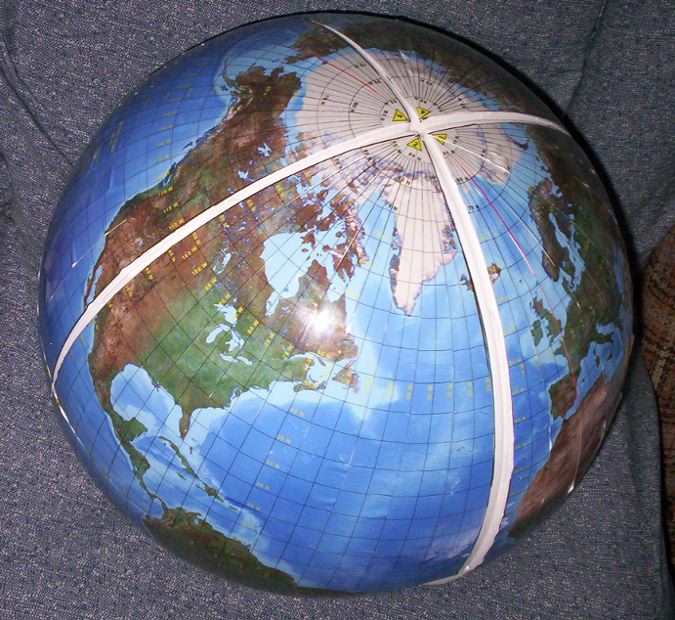
Fig. 8. Again
Octant 6, separated from the northern hemisphere, Eurasia view. (Octants
3 and 4.) Notice the good likeness of the Eurasian land mass on the maps
in figs. 3, 4, and 10, to the global view below.
|
|
| Fig. 9. Northern hemisphere as centered on Octant 2. |
|
|
Fig. 10. Octant 1 as seen on the globe, and the map (partial view at left).
|
For
a half-size image click in it once
at upper left; to restore full size, click in
it twice.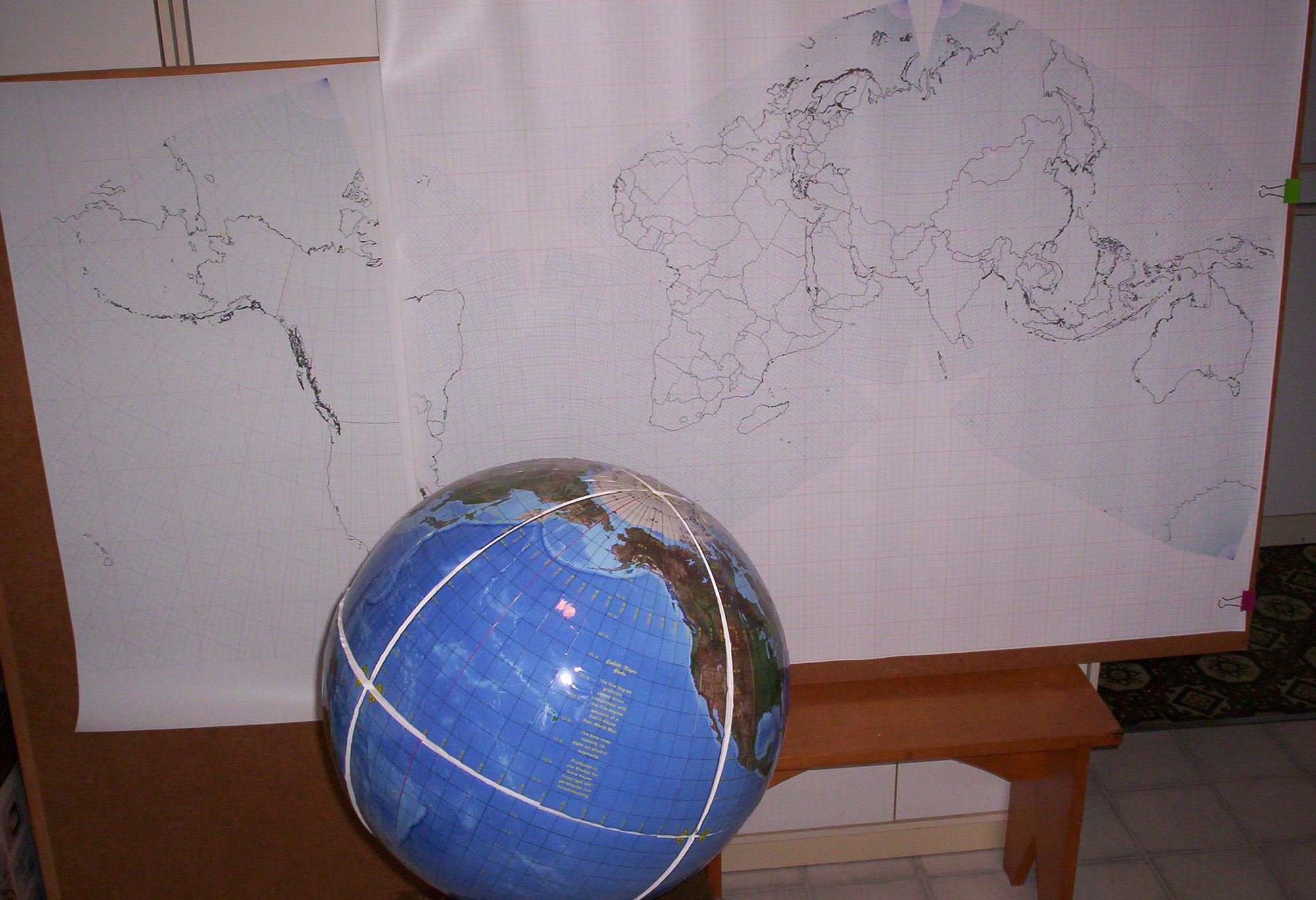
|
|
To conclude, and reemphasize:
A basic principle of the Cahill-Keyes map system is total point for point comparability of map and globe: octant for octant, geocell for geocell, shape for shape. No other world map or globe does this. |