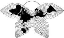
Cahill 1909
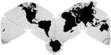
Cahill-Keyes 1975
|
Cahill 1909
|
Go back to Gene Keyes
home page
Cahill-Keyes 1975 |
| Cahill Gallery
2: B.J.S. Cahill's Largest World Map, 1/12,500,000 Illustrated analysis with full-size online images Gene Keyes 2009-03-14 2011-04-12 slightly updated and re-formatted Addendum 2011-11-20: see also photos of Cahill-Keyes test print at similar scale. In 1914 or earlier, B.J.S. Cahill produced an unpublished
prototype of what I believe is his largest ever Butterfly Map, at
a scale of 1/12,500,000, now in the Cahill map collection at
Bancroft Library, University of California, Berkeley.
Based on unpublished papers and correspondence at Bancroft, so far as I know, B.J.S. Cahill's largest published world map was a Cartocraft Desk Outline Map, 16" x 22" (41 x 56 cm), in a scale which I put at 1/74.6 million. It may have been issued in the mid 1920s, but the basic design and size resembled an earlier one dated 1914, "The Circumaviation of the World". C.S. Hammond Co., at their initiative, had made an exclusive Agreement with Cahill in 1924 to print a 1/28 million wall map, and a lot of other Butterfly Map versions, but after much foot-dragging, by 1926 Hammond had reneged. Cahill had also made detailed plans (which I have not seen) for a 1/1,000,000 Butterfly Map at the Los Angeles planetarium, but that too was one of many stillbirths Cahill suffered in the forty-year course of developing his octahedral system of projection. In 1982, while doing post-graduate research on Cahill, I requested Bancroft Library to make color slides for me of this largest Cahill world map. Each is an individual shot of one of its eight octants (which are 27" apiece and not assembled into an entire map, but only hinged as north-south pairs). In 1983, I looked at the map in person during a nine-day visit to the Cahill archives (my only trip to California). In 1984, I also got eight 5" x 7" prints made from the slides. The context was my close study of Cahill's Butterfly Map variations, and drafting of my own Cahill-Keyes map, and template at the somewhat larger scale of 1/10 million, as well as a template for a 1/1,000,000 "Megamap". Personal exigencies then put my Cahill research and development effort on hold for 23 years. (Update 2011-04-11: That project is now underway again, looking toward a computer-drafted Megamap, or any smaller scale.) Fast forward to the Internet age, when in 2007, I made scans of the color prints with an OS 9 Mac and an HP printer-scanner-copier, to re-examine Cahill's largest map. With the scans, I was then able to make a much bigger computer image at the size of the originals, 70 x 69 cm (27" +), and upload them here. Those poster-size versions cannot be seen in their entirety unless you have a very big monitor, so I am also including a set of reductions to 25% of original in the appendix, at 1/50,000,000. The thumbnails here are 1/200,000,000, or 06.25% of the original. Click thumbnails for full-size version; each
opens in separate window.
Source: original at Cahill map collection, Bancroft Library, Scanned and re-enlarged to their actual size by Gene Keyes
Using the full-size images, I offer the following observations:
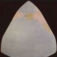
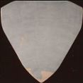
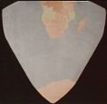
1) Date: Despite the "n.d." in the Bancroft index, it is apparent from the pre-W.W.I European boundaries that the map is probably ca. 1914, perhaps contemporaneous with a 1914 published map of Cahill's, "Circumaviation of the Globe" (index item # 50), and its very similar derivative, the Denoyer-Geppert Cartocraft Desk Outline Map cited above. (Index item # 54.) These latter two printed versions do not have national boundaries. 2) Prototype content: Hand drawn; hand colored; very detailed as to coastlines, lakes and rivers. It also has national boundaries, unlike the published ones above. States, provinces, and cities are not included, and there is no lettering on the map. Octant #3, Europe; N. Africa. For full size
in separate window, click here.
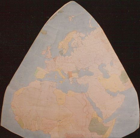
Image reduced to 25% of original; all eight at this size are in the appendix below. Scale here is 1/50,000,000. 3) Profile: As mentioned, the octants are not
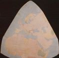
grouped into a single map, but exist as [adaptable] N-S pairs. Below
is a composite arrangement by me in the Atlantic M-layout at 1/200,000,000,
or 16 times smaller in length than such an assembly at its actual size,
which would be over 5 feet tall and 10 feet wide (1.6 x 3.2 meters).
[This illustration has to be regarded as quite a rough sketch, given the age of the map, and various imprecisions of photography, scanning, and computer graphics.] 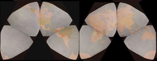
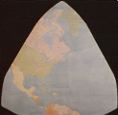
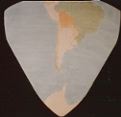
Here is the New World portion, at twice the scale above 1/100 million, or one-eighth the length of the original. (Edge mis-alignments are due to my computer-graphic imprecision, not the map's.) 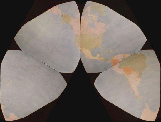
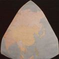
And the Old World portion: 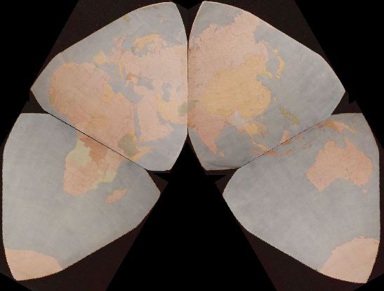
4) Scale: The Bancroft Library index says it is 1/14,000,000;
but by the criteria I have devised to compare scales among Cahill
maps, I deem it to be 1/12,500,000.
5) Graticule: For me, the hallmark of accurate world map design is a fine-grained graticule, preferably 1º geocells, but at least 5º. So while I was very pleased to find Cahill's largest map, I was disappointed that its graticule was such a far-spaced example: 10º N-S, and 15º E-W (plus 7 1/2º E-W at the edges, due to Cahill's choice of 22 1/2º W for the dividing meridian). As I state in my Cahill gallery and elsewhere, Cahill thought his master stroke of map symmetry was that 22 1/2º W meridian, but it spoiled the graticule, and introduced a plethora of unsightly half-degrees at every octant's longitudinal edge. Sometimes, as in his original 1909 version, they are concealed by 7 1/2º geocells, which misleadingly resemble 5º geocells. Here, we have another early example of 7 1/2º geocells E-W, mismatched with 10º N-S. The only Cahill map I have seen with a 1º graticule was a 1/20,000,000 Conformal variant he was proposing for a synoptic world weather map: but even this was not executed in an entire world map version; and the graticule did not extend into land areas. There are some, but very few, draft and published Cahill maps, which have a 5º graticule; they show up the split-seam geocells all too badly. I will be posting all these later. (See an example at Fig. 9.2.1 here.) Before switching to Cahill, I had spent much time (in my 1973 MA thesis* and beyond) working with Buckminster Fuller's 1954 icosahedral Dymaxion map — but even the large 1/21,000,000 copy I was using had a far-flung 15º graticule. It was only when I began filling in a one degree graticule myself, that the imperfections and irregularities and asymmetries of Fuller's map became manifest. The elegance of Cahill's design as compared to Fuller's was decisive for me, in seeking an all-purpose base map of the world. But as I looked to larger scale versions of Cahill, his half-degree problem became bothersome, as did disparities among adjacent geocells. Still judging Cahill's design to be far superior to all others, I drafted my own variant of Cahill at 1º and 1/20,000,000, with various tweaks, and avoiding half-degree geocells. (Steve Waterman's independently designed octahedral likewise avoids half-degrees, and sports a 5º graticule at 1/44,000,000.) . * ^ Gene Keyes, Six Principles for a Unified Map System (Applied to the China-Russia Situation) Carbondale, IL: Southern Illinois University, M.A. thesis in Government; 1973; 217 p. + 49 maps. 6) Concluding thoughts: There is a very small
number of actual Cahill maps (all of which are very small and badly
printed) in cartography books or articles — if he is cited at all. So
I am glad to know that original large-scale Butterfly Maps exist in his
archives at U. Cal. Berkeley, this one being the biggest. Despite the
lack of 1º geocells, it is an admirable work. And, unlike, for instance,
the abominable Homolosine, it confirms that no matter how large, a Cahill
map is still the best alter ego of a globe.
^ APPENDIX
Herewith are the 8 octants at 1/50,000,000, or 25%
of their original dimensions.
(For links to full-size images, return to thumbnails.) Source: original at Cahill map collection, Bancroft Library,
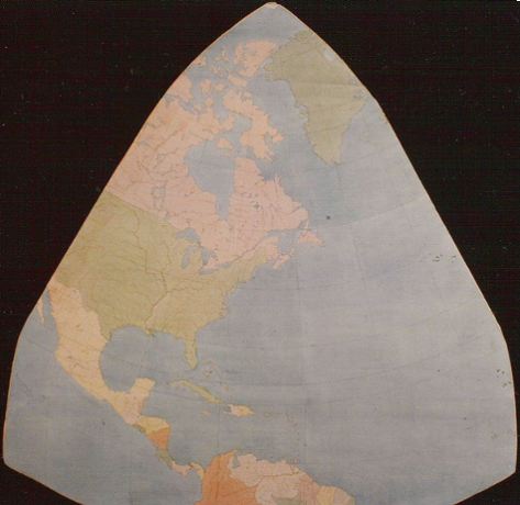
University of California, Berkeley. Scanned and reduced to 25% of actual size by Gene Keyes from prints of slides provided by Bancroft Library. #1: N. Pacific 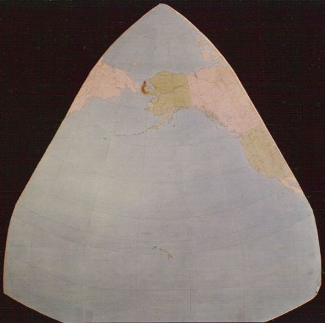
#2: N. America
#3: Europe; N. Africa
#4: Asia 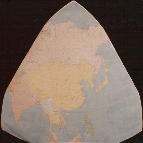
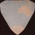
#5: Australia 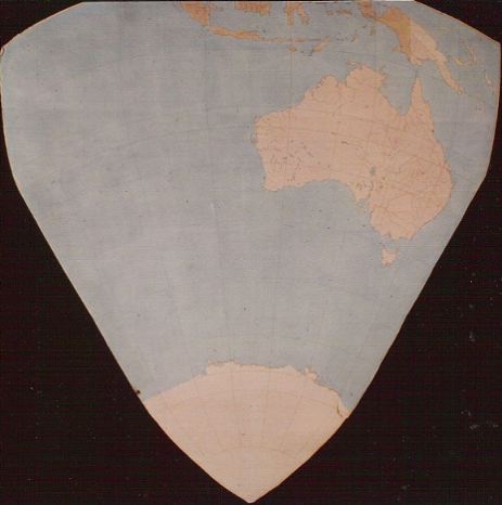
#6: S. Pacific 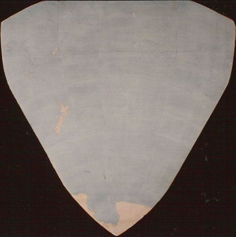
#7: S. America 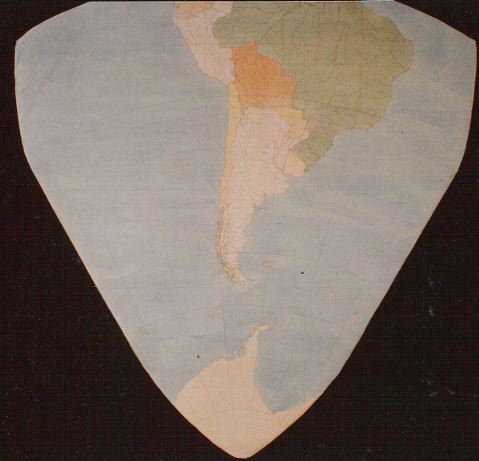
#8: S. Africa 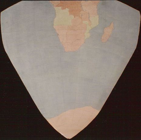
|