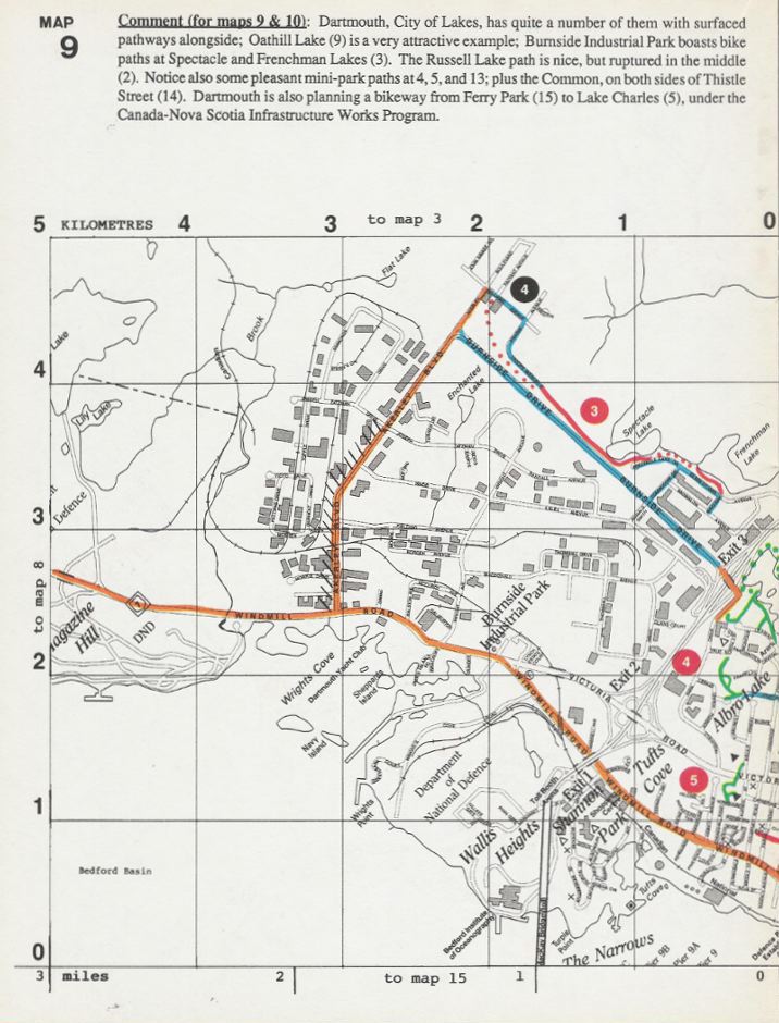
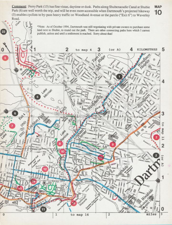
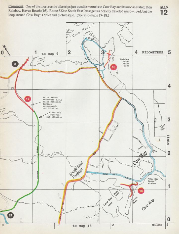
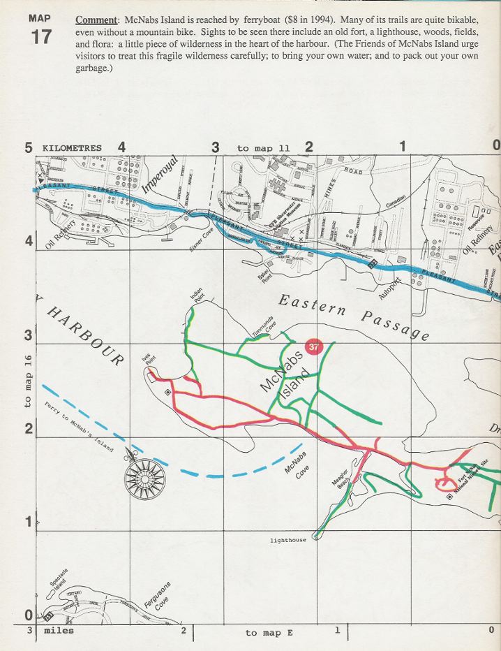
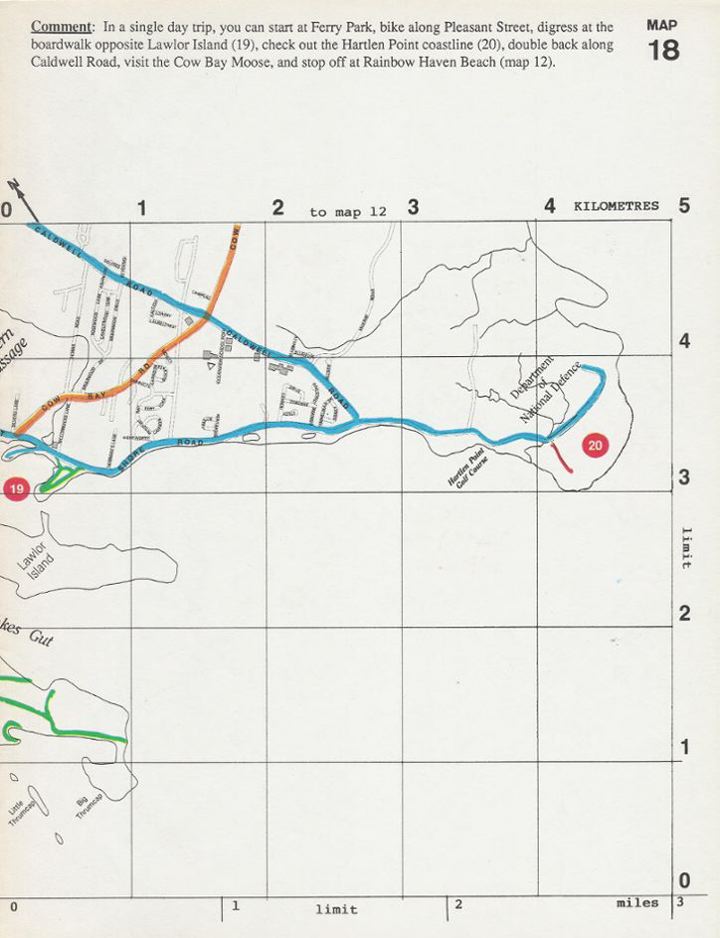
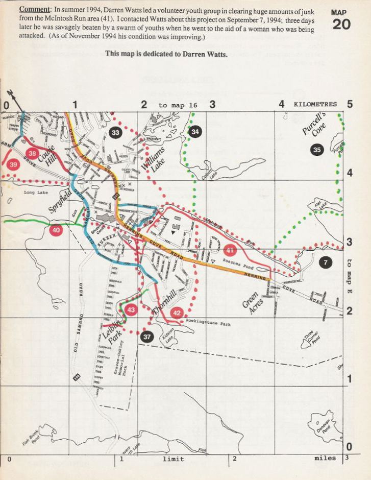
|
METRO-PED
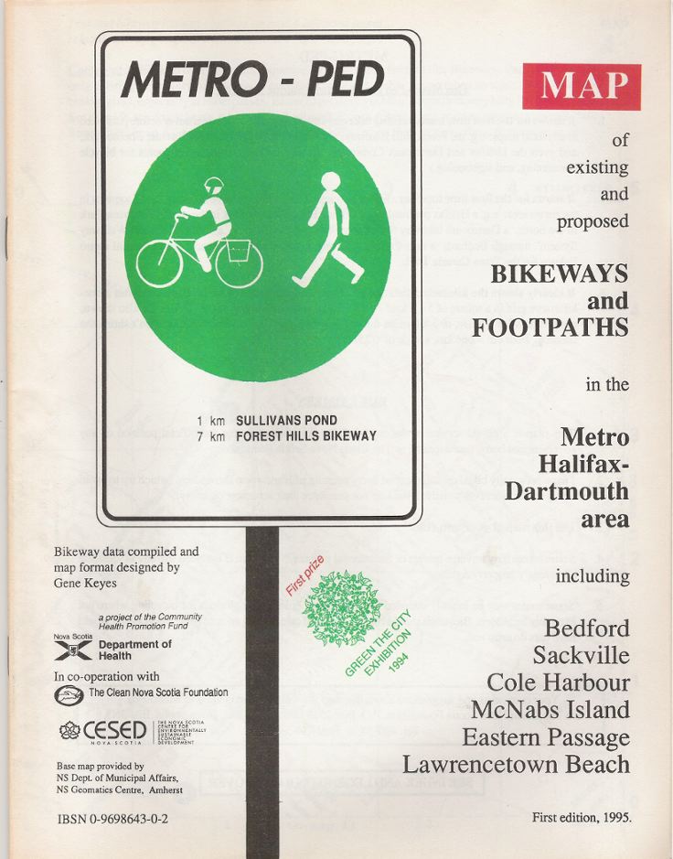
Map of Existing and Proposed Bikeways and Footpaths in the Metro Halifax and Dartmouth Area including Bedford, Sackville, Cole Harbour, McNabs Island, Eastern Passage, and Lawrencetown Beach Compiled and designed by Gene Keyes Original print version published 1994-12-13 Online reprint 2010-06-29 This is a re-issue, in jpegs, of an award-winning
bikeway map pamphlet for Halifax and vicinity, which I produced
in 1994 with a grant from the Nova Scotia Department of Health's Community
Health Promotion Fund, and sponsorship by the Clean Nova Scotia Foundation.
Shortly afterward, the areas covered here were merged into a single
Halifax Regional Municipality. At the time, it was generally a bicycle-un-friendly
city; one could not even ride a bike across the MacDonald bridge,
but had to dismount and walk. (See photo at end.) Since then, a special
bike lane was built onto the bridge; and other bikeways and paths have
been developed. Meanwhile, in 2003 I "retired", and moved from Halifax
to the small Nova Scotia town of Berwick.
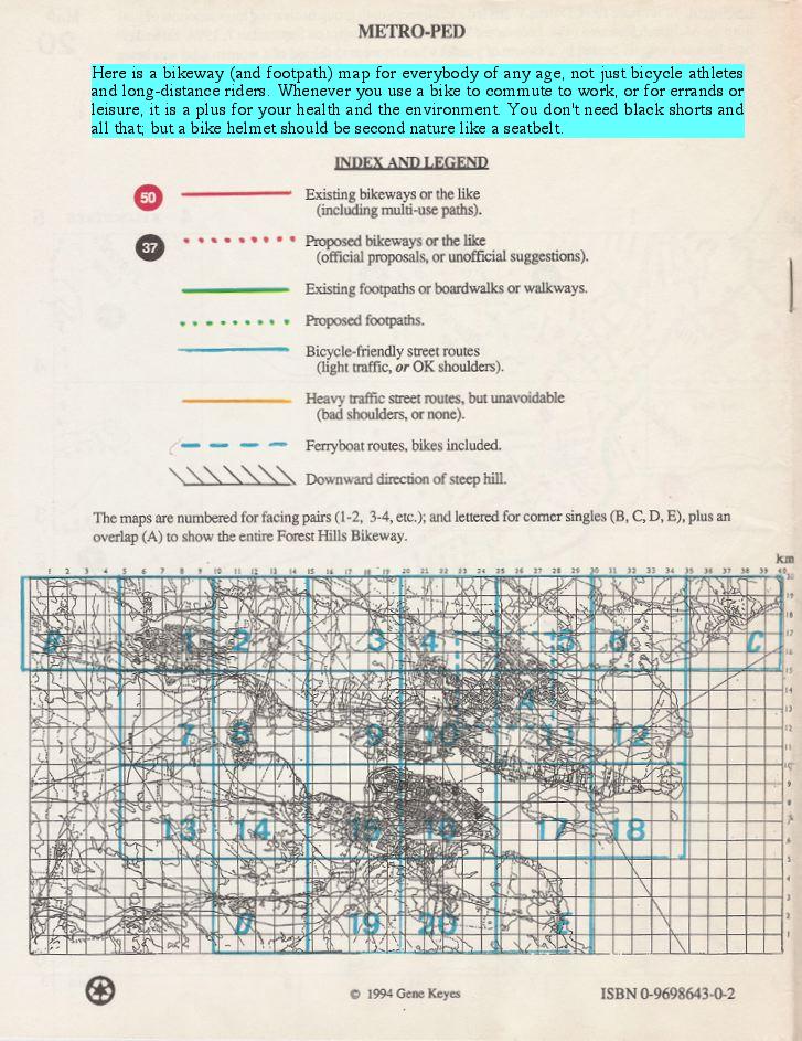
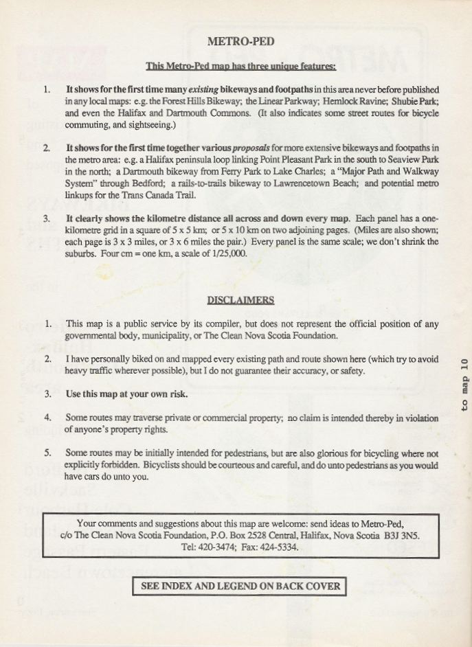
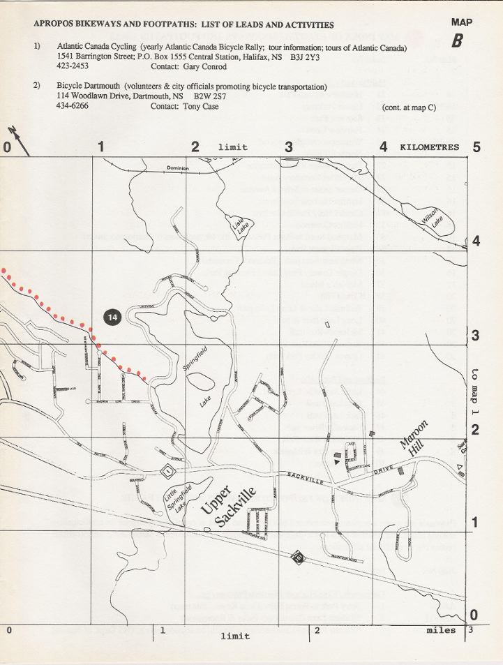
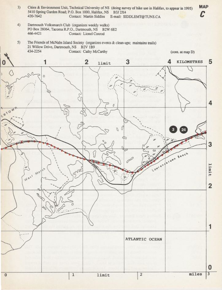
The purpose of this map was to scrounge up as many bits and pieces and hints of actual bikeways (and walking paths) as I could find, and also to compile ideas and proposals for more of them. In addition, the map had a pair of graphical innovations: 1) As mentioned below, it shows the entire kilometer distance across the length and width of each map (plus miles). 2) Not mentioned, is that this bikeway map also ties into my "Coherent World Map System", based on the octahedral projection of B.J.S. Cahill (1866-1944), whose design bears better resemblance to a globe than any other (including Buckminster Fuller's). While the base map was provided by the NS Geomatics Centre in Amherst, I added the grid, the bikeway data, other details, and oriented it as if it were a cut-out from a total world map: my adaptation of Cahill's. That is why the North arrow tilts left, which is how the Maritimes' meridians would appear in this global profile. (For more details, go here.) Remember that this map was issued in 1994, and that many of its contacts and addresses are out of date, including mine. As of 2010, my e-mail is gene.keyes--at--gmail--dot--com Note: For this Web version, I have scaled up the map to 1/20,000 (on my 19" monitor; yours may be different). The original was printed on 8" x 10.5" pages, unfortunately reducing the scale to 1/26.000. However, for those who wish to make hard copies, I have provided a printer-friendly zip-file of all these pages at their smaller original size. Click here.PS: I also designed the glyph below, to show a casual cyclist sitting up, not hunched over the handlebars for racing. See also notes at end about an unfinished bikway-sign project. |
|
Contents
• Cover • Index map and legend [back cover] Text pages:
• Introduction• Map Index of existing bikeways and footpaths (2 p.) • Map Index of proposed bikeways and footpaths (2 p.) |
Map pages:
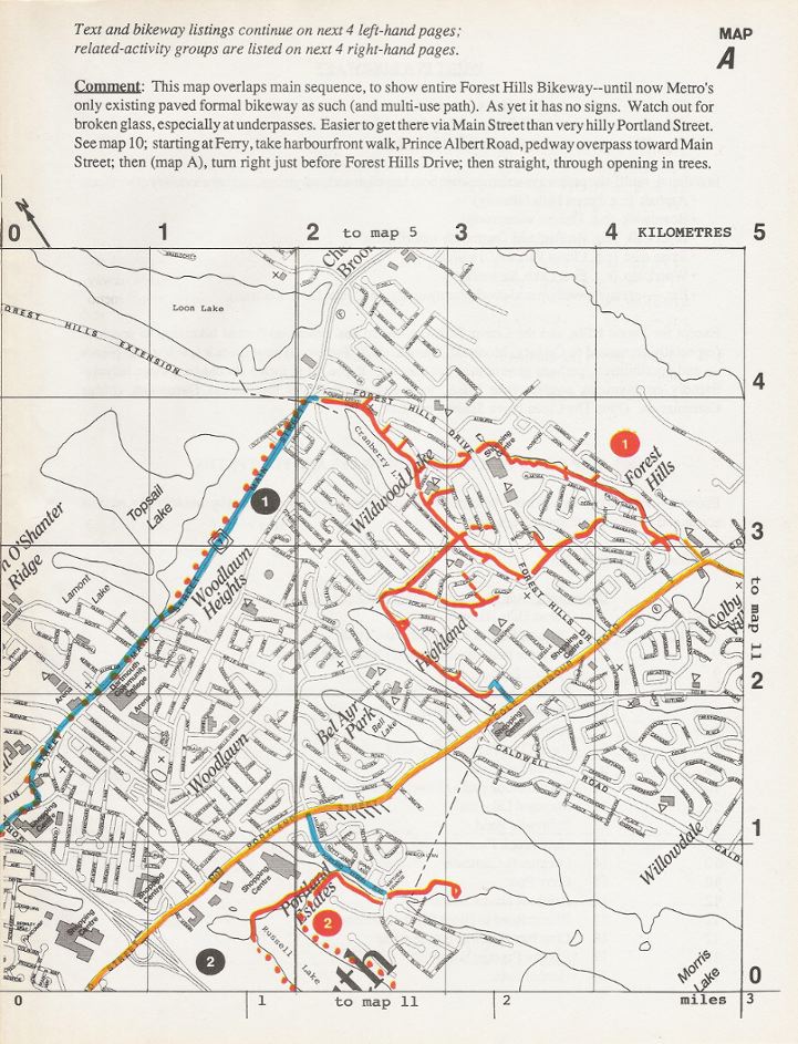
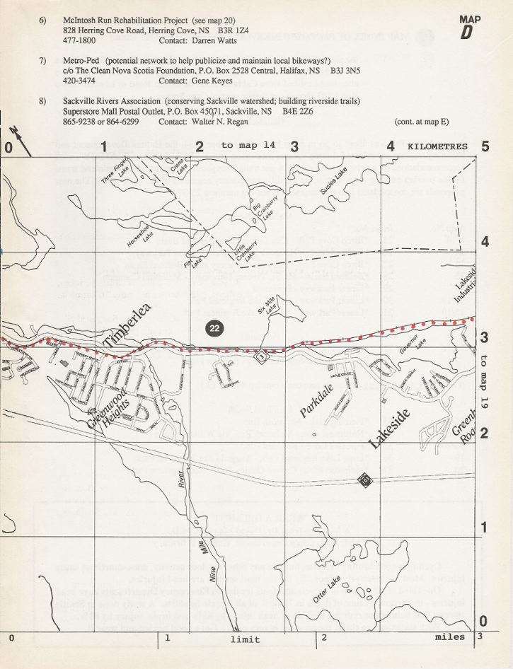
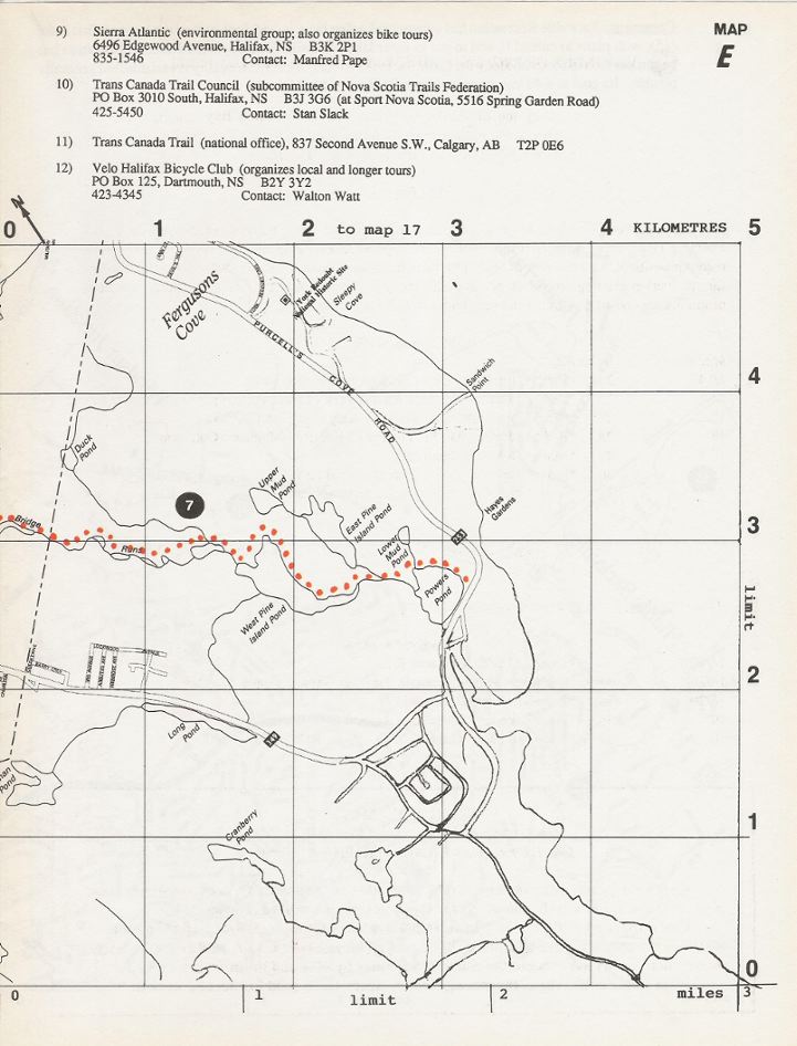
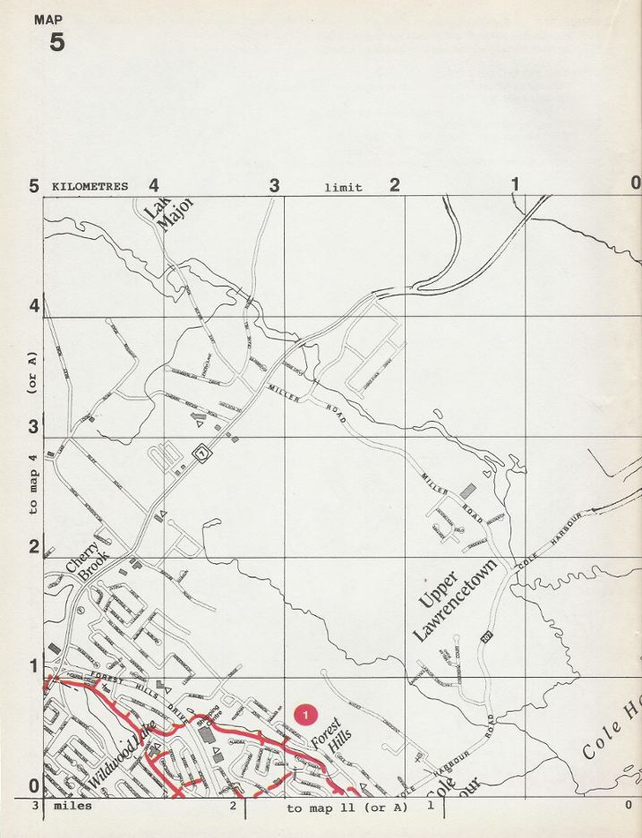
• A Forest Hills Bikeway• B • C • D • E (outer reaches) • 1-2 Lower Sackville • 3-4 Port Wallace, etc. • 5-6 Cole Harbour, etc. • 7-8 Bedford • 9-10 Dartmouth • 11-12 Eastern Passage, etc. • 13-14 Birch Cove, etc. • 15-16 Halifax • 17-18 McNabs Island, etc. • 19-20 Spryfield, etc. |
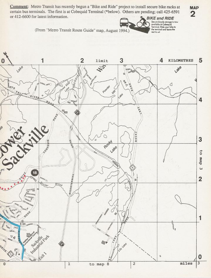
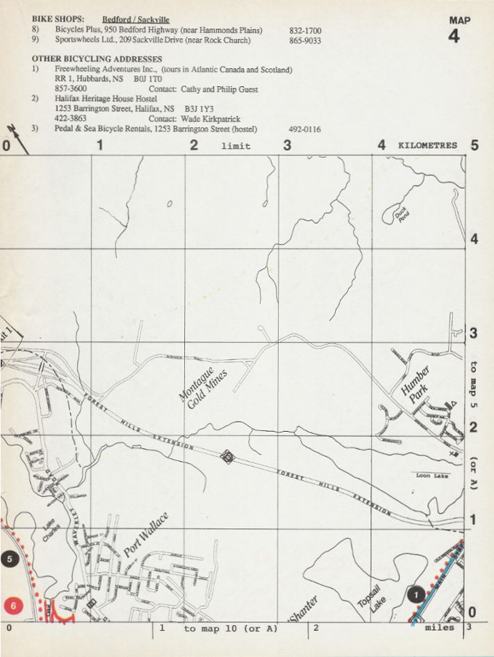
| Remember
that this map was produced in 1994, and that many of the contacts
and addresses are out of date.
Back cover and index:
|
|
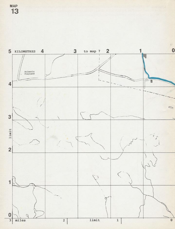
Remember
that this map was produced in 1994, and that many of the contacts
and addresses are out of date.
Back cover and index: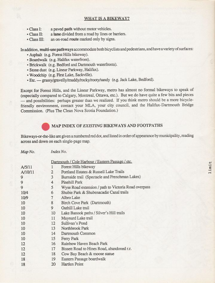
|
Remember
that this map was produced in 1994, and that many of the contacts
and addresses are out of date. 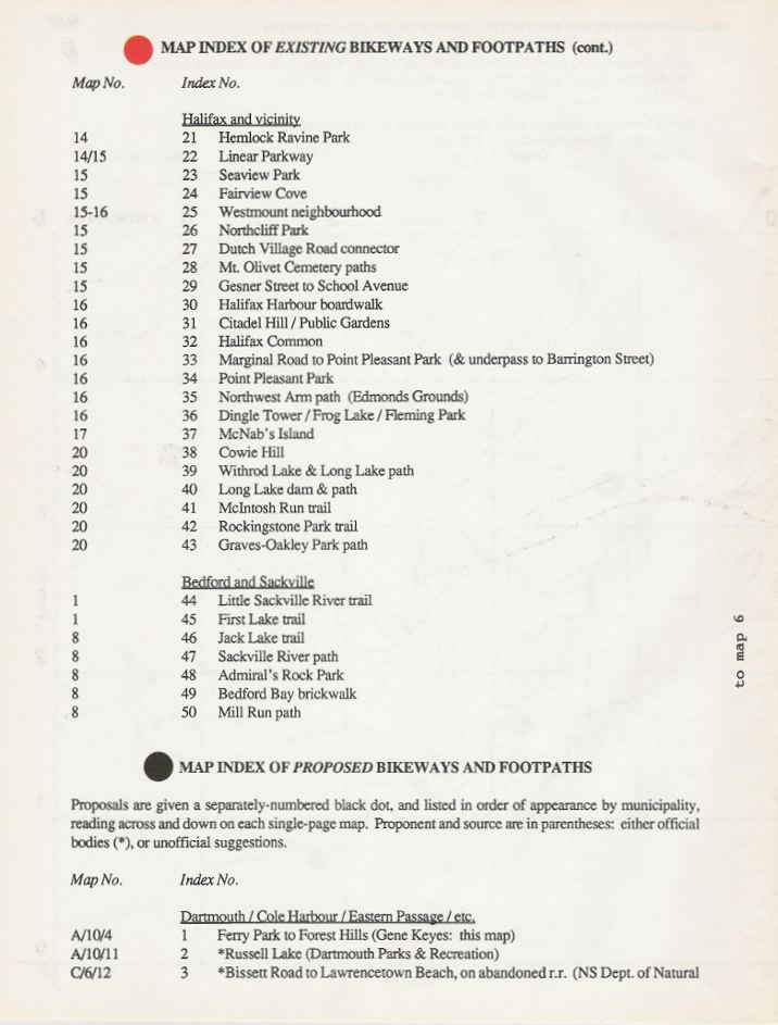
|
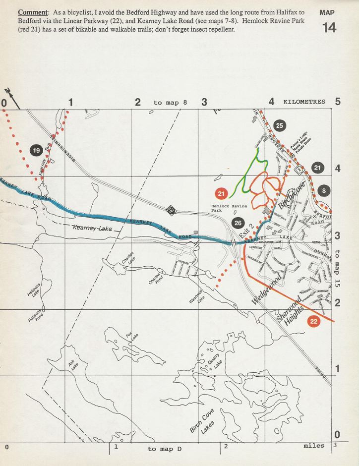
Remember
that this map was produced in 1994, and that many of the contacts
and addresses are out of date. 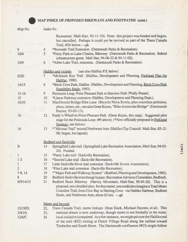
|
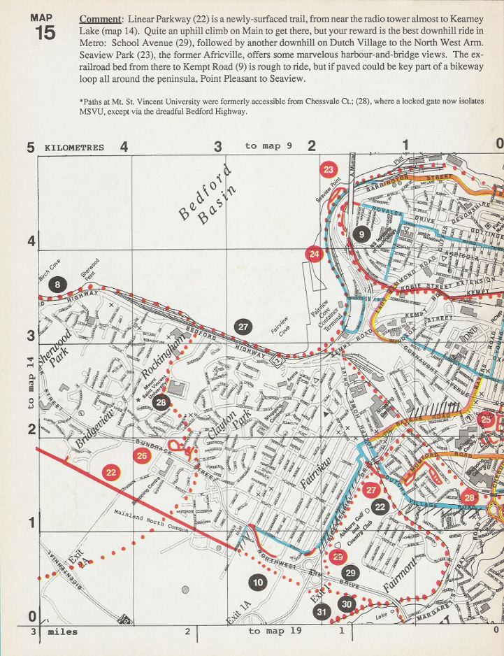
Remember
that this map was produced in 1994, and that many of the contacts
and addresses are out of date. 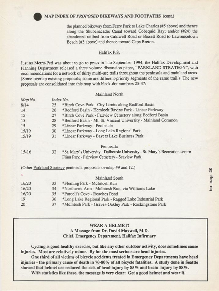
|
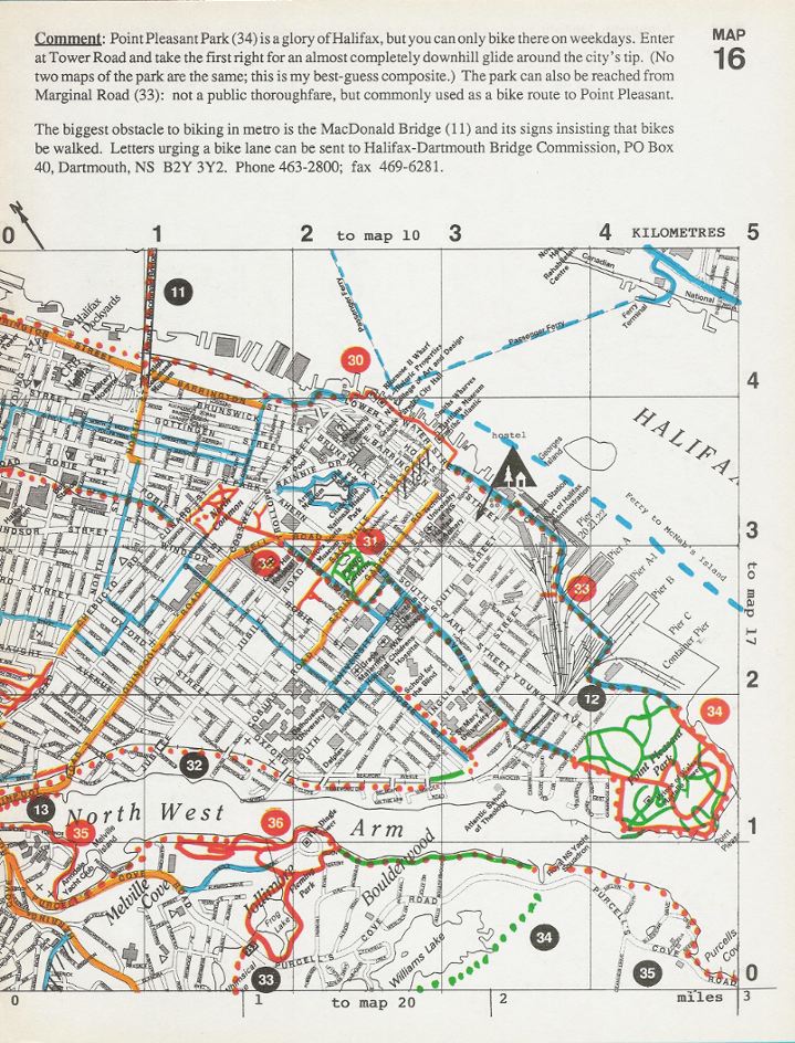
Remember
that this map was produced in 1994, and that many of the contacts
and addresses are out of date. 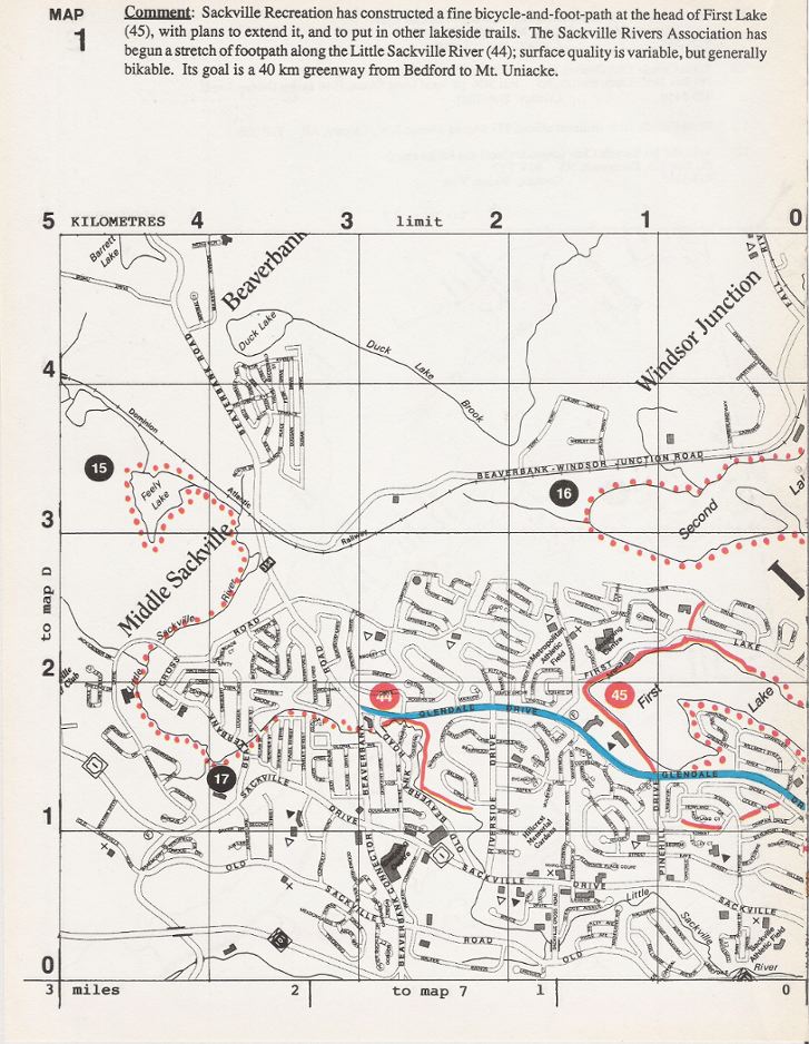
|
Remember
that this map was produced in 1994, and that many of the contacts
and addresses are out of date. 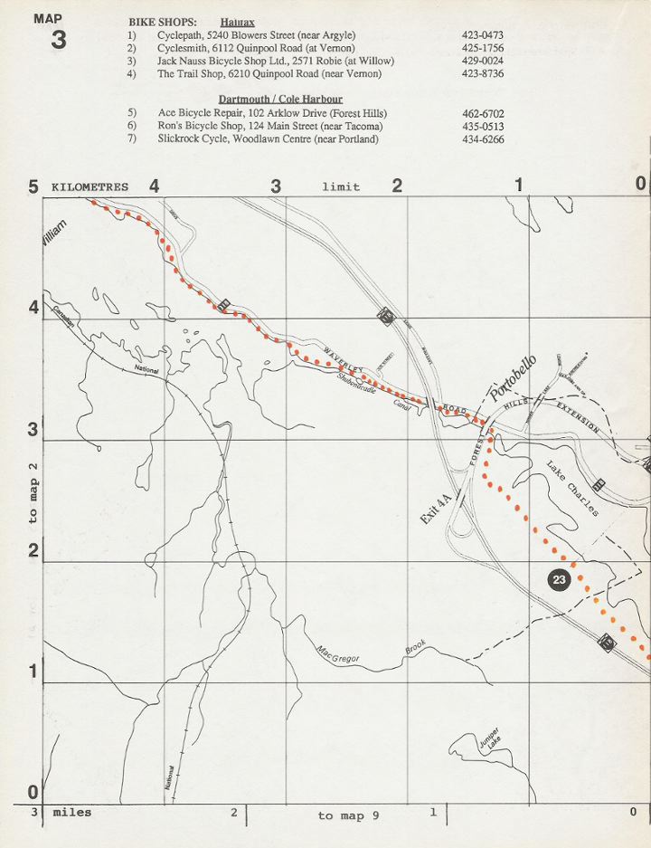
|
|
|
|
|
|
|
|
|
Gene Keyes in 1993, the bad
old days, before MacDonald Bridge had a bikeway.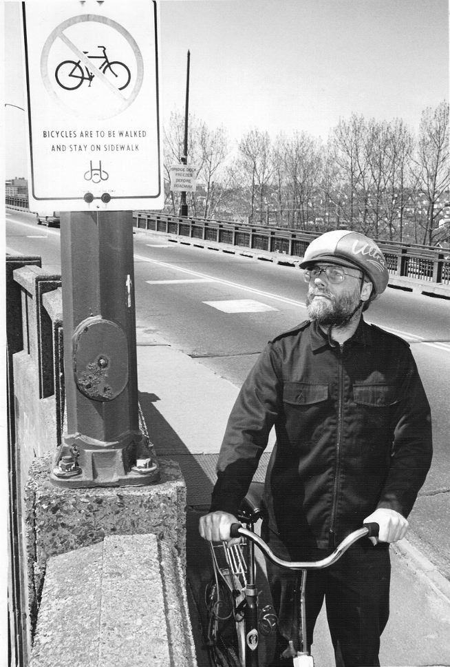
Photo by Ron Faulkner, from Dartmouth Patriot,
May 13-19, 1993.
Gene Keyes on the Forest Hills Bikeway, 1993; then almost the only such network in the greater Halifax area. 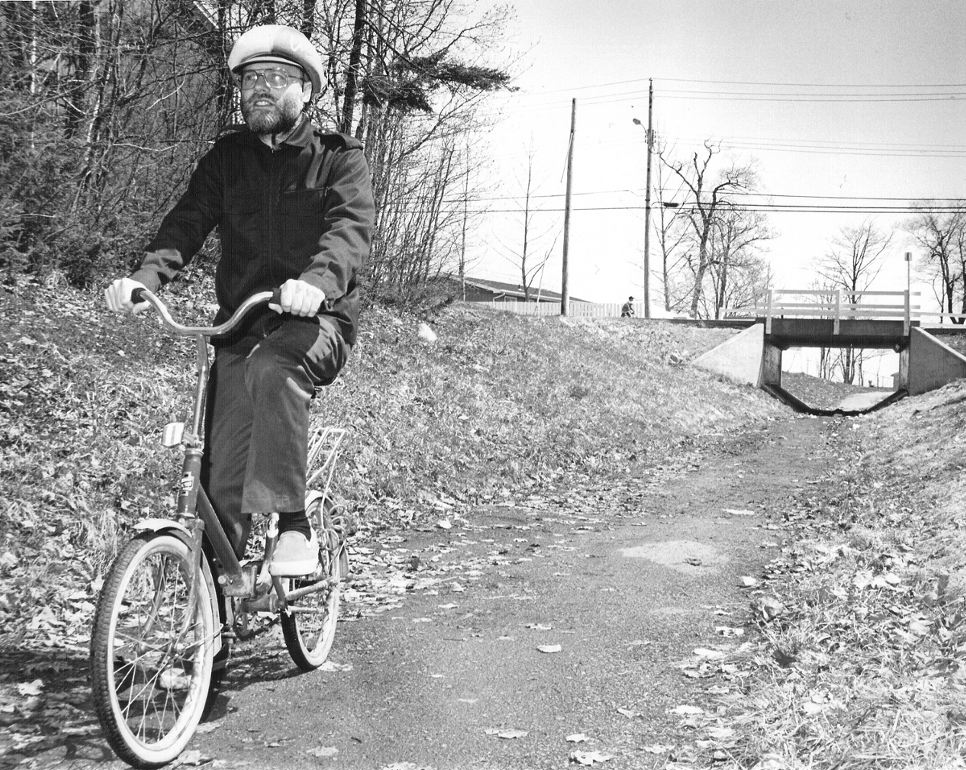
Photo by Ron Faulkner, from Dartmouth Patriot, May 20-26, 1993. |
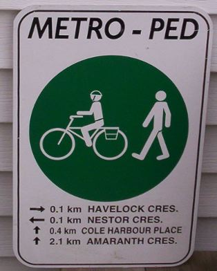
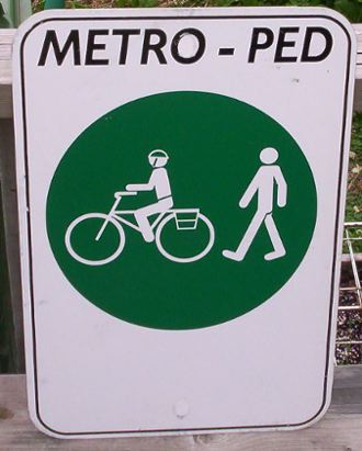
Sign on left was one of a set for Forest Hills. Sign
at right was not finished by the shop; but perhaps it would have been better
that way, and the distance captions were an over-reach.
|