c. 1975, 1980, 2006, 2009 by
Gene Keyes.
(But I'm not a big stickler on intellectual
property rights.)
;-)
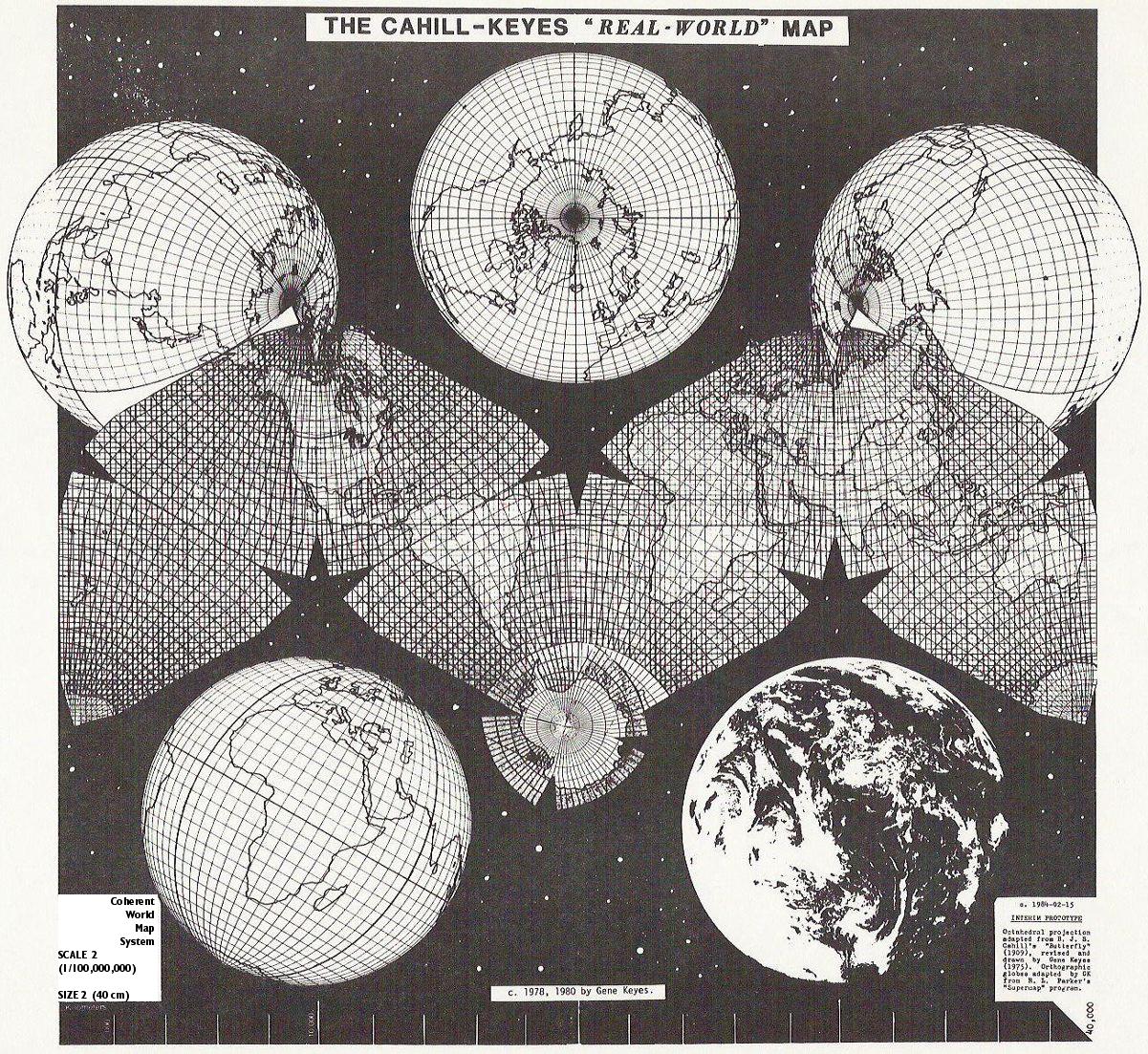
This and the smaller version
on my home page are replicas of an existing 1/20,000,000
"Jr. Master" wall map 2 meters wide, and an exact floor
plan of a proposed 1/1,000,000 "Mega-map" with sides 40 meters or 132' wide.
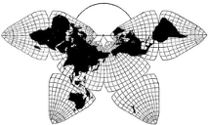
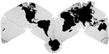
This map is adapted from the B.J.S. Cahill
octahedral "Butterfly" projection, published in 1909.
The graticule was newly devised, computed, and drawn
by Gene Keyes in 1975, along with the coastlines, boundaries,
and overall map design.
1975-11-11,
original GK version
1980-05-02,
first print
1984-02-15,
second print
2006-04-22,
first online posting
2009-03-24, re-formatted online posting
Scale adjustment for varying computer
screens:
Your mileage may vary! Monitor size and settings
make a difference. If the distance between the outer tics is 400 mm, then
the map depicted is 1/100 million, as in its "original". In any event,
the span shown is 40,000 km, representing the unfurled circumference of
the earth.
This HTML web page and map jpeg were originally produced on a Mac G3 and
a 19" LCD monitor with a resolution of 1024 x 768, + 75 hz. If you want
the real scale as seen on your screen, measure the distance in millimeters
(which is variable) between the first 2 numbered tics, then divide that into
the kilometer distance (which is constant) at the middle tic, and add the
term "million".* For example, on my 17" monitor hooked to a Linux Asus eee
701 with the same resolution, the midpoint distance is 178 mm, not 200, as
in my "original". Dividing 178 into 20,000 indicates that on that monitor
the scale is 1/112 million, not 1/100 million. See also my " Notes on Scaling Cahill and
Cahill-Keyes Maps".
* The above division is a shortcut, to avoid
entering a lot of zeroes in a calculator, and we take a readout of, say,
112.3.... as the fraction 1/112 million.
Metrically, the earth's circumference is approximately 40,000 kilometers,
or 40,000,000,000 millimeters (forty billion), there being 1,000 millimeters
in a meter, 1,000 meters in a kilometer, and 1,000,000 millimeters in a kilometer.
So if we have a [Cahill-Keyes] world map that is 400 millimeters long,
equatorially, and the equator being 40,000,000,000 millimeters around, we
make a fraction of
400 mm
40,000,000,000 mm
knock off a couple of zeros:
4 mm
400,000,000 mm
reduce:
1 mm
100,000,000 mm
and get the scale of 1/100,000,000. (Representative Fraction.)
Which is also to say:
Each millimeter on the map represents 100,000,000 millimeters on the ground.
Or, knocking off six zeroes to convert to kilometers, 100, we say that each
millimeter on this map represents 100 kilometers on the ground.
Or, if your computer has made this map somewhat smaller than the original,
as in my example above, then each millimeter represents 112 kilometers,
not 100.
|