Program "CKOG-plus" (attached here as a pdf to preserve its formatting) has all the subs (functions
and subroutines) necessary to convert any longitude - latitude point on the
globe to either the 8-octant map coordinates or to those of Gene's 1-octant
map coordinates (using version 8). This program could replace program "HalfOctant8";
besides converting latitude - longitude to M-map or Gene's 1-octant coordinates,
it can calculate anything that earlier program calculates (except arrays
dP and L, which were useful in "HalfOctant8", but are not really needed).
However, program "HalfOctant8" computes the 1-degree graticule more efficiently.
It calculates meridian joints for each meridian only once, and all the parallel
crossings a region at a time. Program "CKOG-plus" determines the region and
calculates meridian joints for each point, rather than for each meridian,
because it needs to handle longitudes and latitudes that are not whole degrees
when converting coastal data.
The program includes lots of comments (lines or parts of lines starting
with #), such that it should be reasonably easy to follow by anyone wanting
to convert it to a different language, even if they don't know Perl.
Lines 1 and 3 are necessary for Perl programs, at least those run on
Linux; the first tells the computer that this program is in Perl, and the
other imports the library of trigonometric commands.
Line 5 [($sin60, $cos60, $yTranslate, @Prelims) = Preliminary();] is
essential for anything one might want to compute. It calculates a bunch of
values (see Fig. 3 and 6)
needed by other subs, and assigns them to 3 variables and one array (@Prelims).
Sub Preliminary() calculates those values which are likely to be used over
and over again, and are, therefore, best calculated only once. It is in this
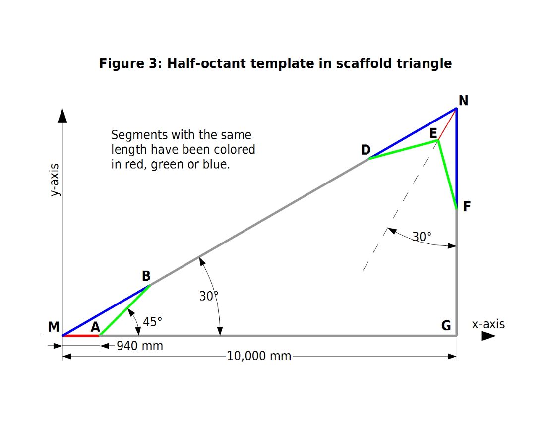
sub that points M, A, B, C, D, E, F, G, T and several lengths, including
R, are calculated. Note that sub Preliminary() calculates the coordinates
of point N, but does not output them, as they are not necessary for any subsequent
calculation.
The remaining commands before the line with the word "S U B R O U T
I N E S" (with all the spaces) were included just for the purpose of demonstrating
how the subs are used. This section of the program includes several optional
blocks that calculate different things. I call them the SKIP blocks. Variable
$SKIP is set to "" (empty string) for the block to be executed, or to just
about anything else (I use "YES") to skip it. Here's a summary of these blocks:
1 – Printing out the values returned by sub Preliminary(), except for
the first three values, in a CSV (comma-separated values), or rather, a tab-separated
values format which might be read by spreadsheet programs. I used this to
compare with the values in the Hashes8.csv file output by program HalfOctant8.
2 – Calculating and printing out joints and ends of each whole-numbered
meridian in the half-octant. These values can be used to prepare commands
to draw the meridians. These are the xJ and yJ arrays listed in the Hashes8.csv
file.
3 – Calculating and printing out every point in the half-octant whose
longitude and latitude are whole degrees. These are the xP and yP arrays
listed in the Hashes8.csv file, which can be used to draw the whole-degree
parallels.
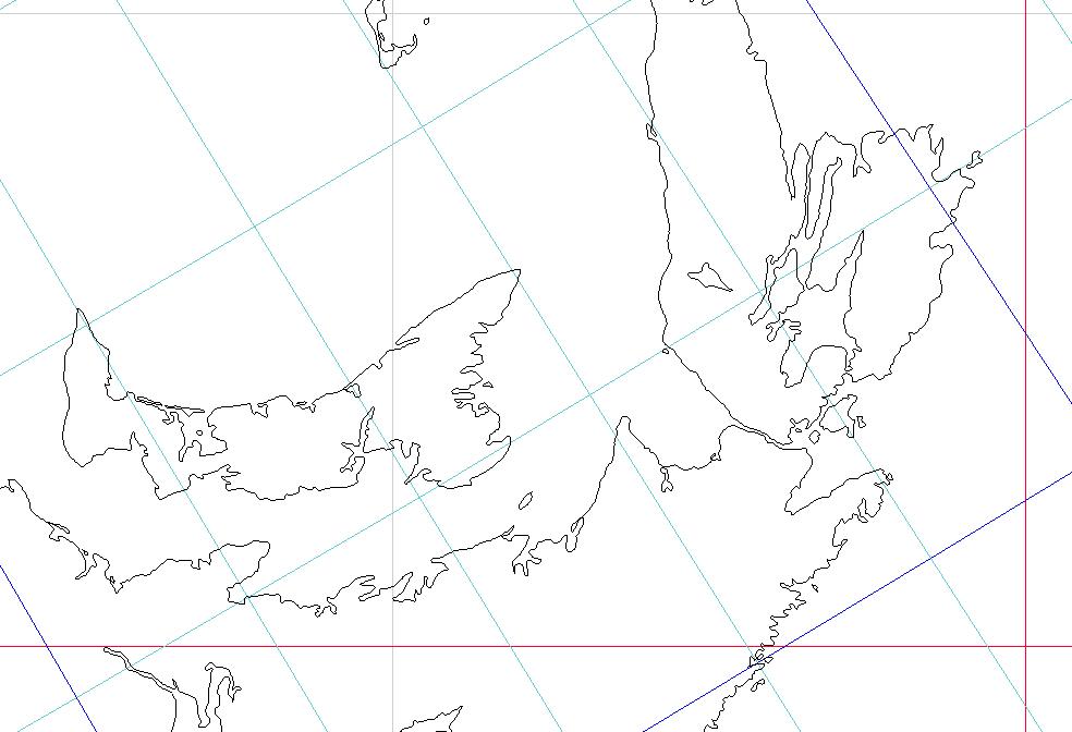
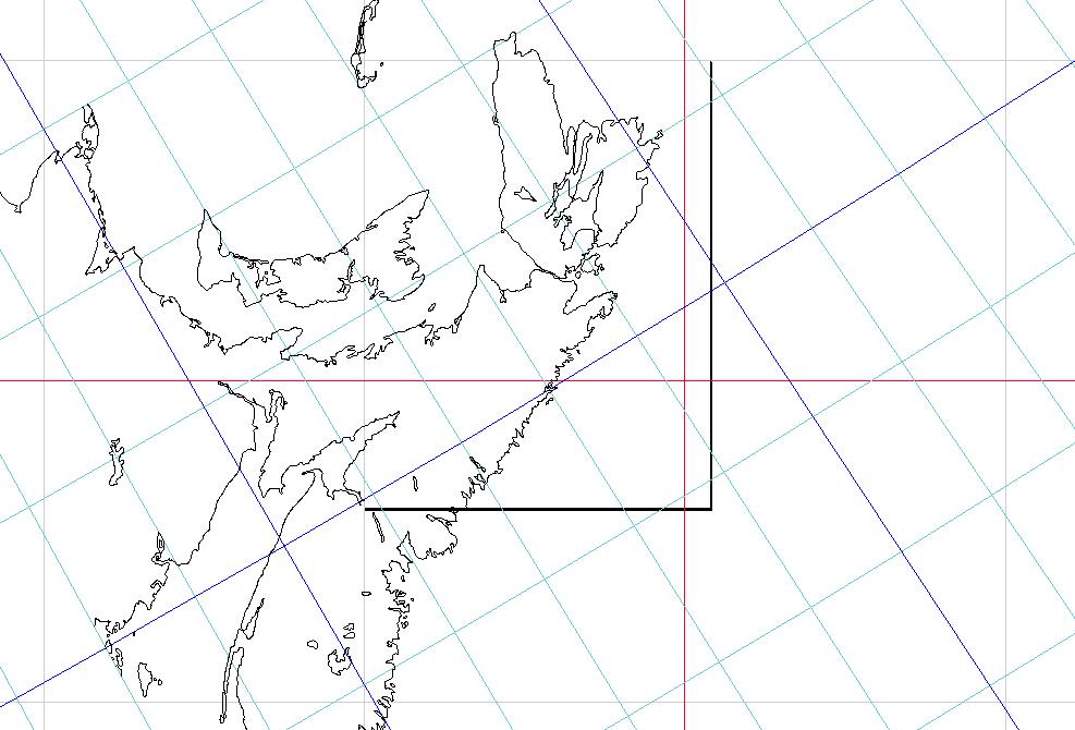
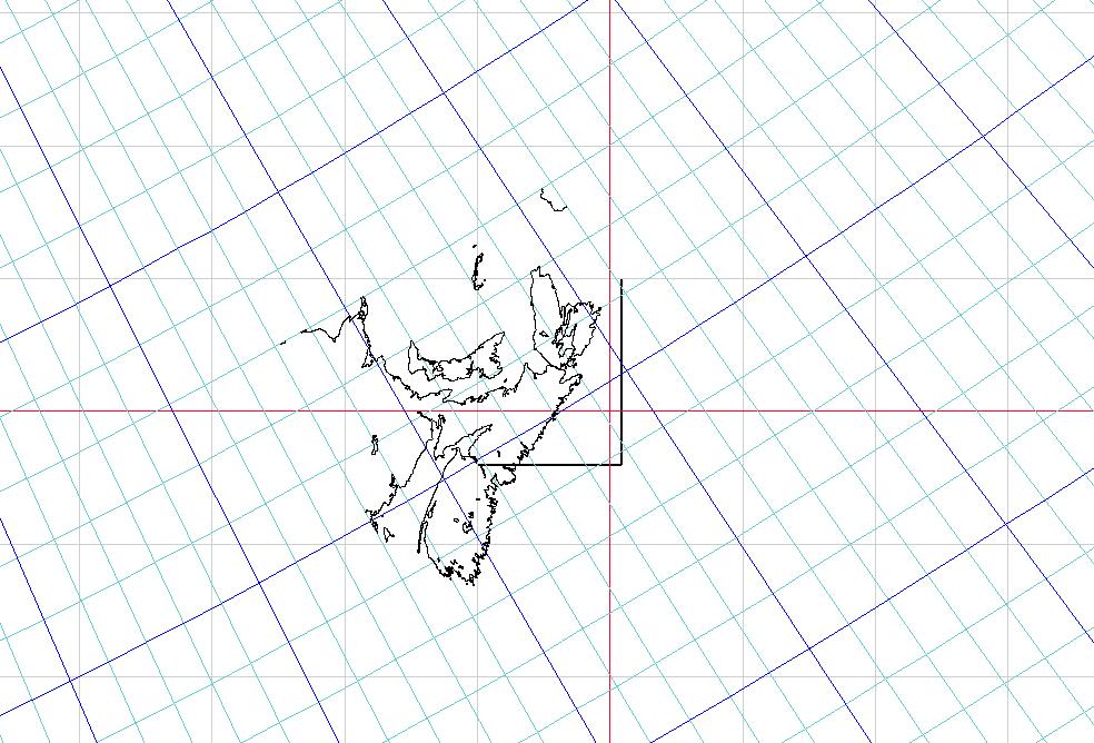
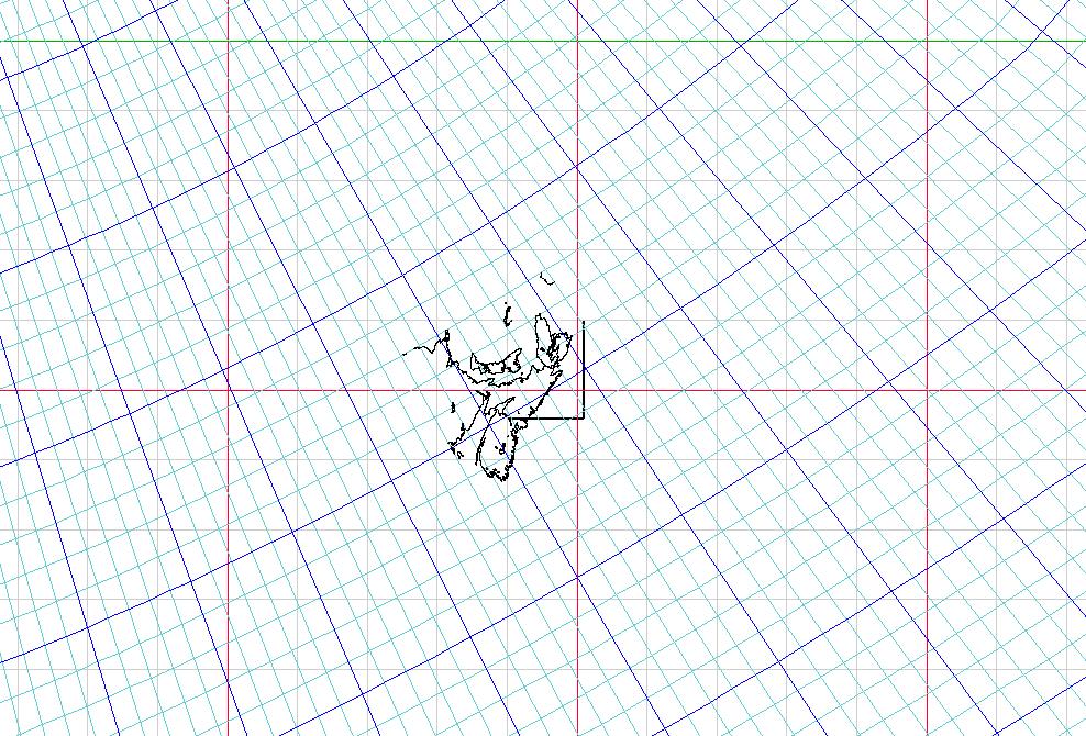
4 – Reading in a coastline data file in MAPGEN format, and converting
the data first to half-octant template coordinates, and then to either Gene's
one octant or eight-octant-M-map coordinates, and outputting a macro to plot the coastline
using OpenOffice.org Draw. (The macro presupposes the existence of macro
functions P, L, and Collect, which are in All-macros-part-1.odt,
http://www.genekeyes.com/CKOG-OOo/5-CKOG-OOo-macros-via-Perl.html.)
Note that converting data from half-octant template to any octant
in M-map coordinates is demonstrated in the last block. One could use the
half-octant template values calculated in blocks 2 and 3, and run them through
sub MJtoG() giving values 1 to 8 for variable $Octant, to calculate the graticule
for the whole M-map.
Here is a list of the subroutines and of the figures that they relate to:
Sub Preliminary() — calculates values often needed for other calculations — refer to fig. 3 and fig. 6.
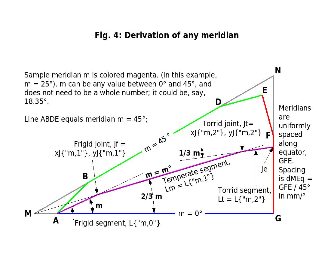
Subs Equator() and Joints() — used by other subroutines; these calculate meridian intersection with equator (Je) and meridian joints (Jt and Jf) — refer to fig. 4.
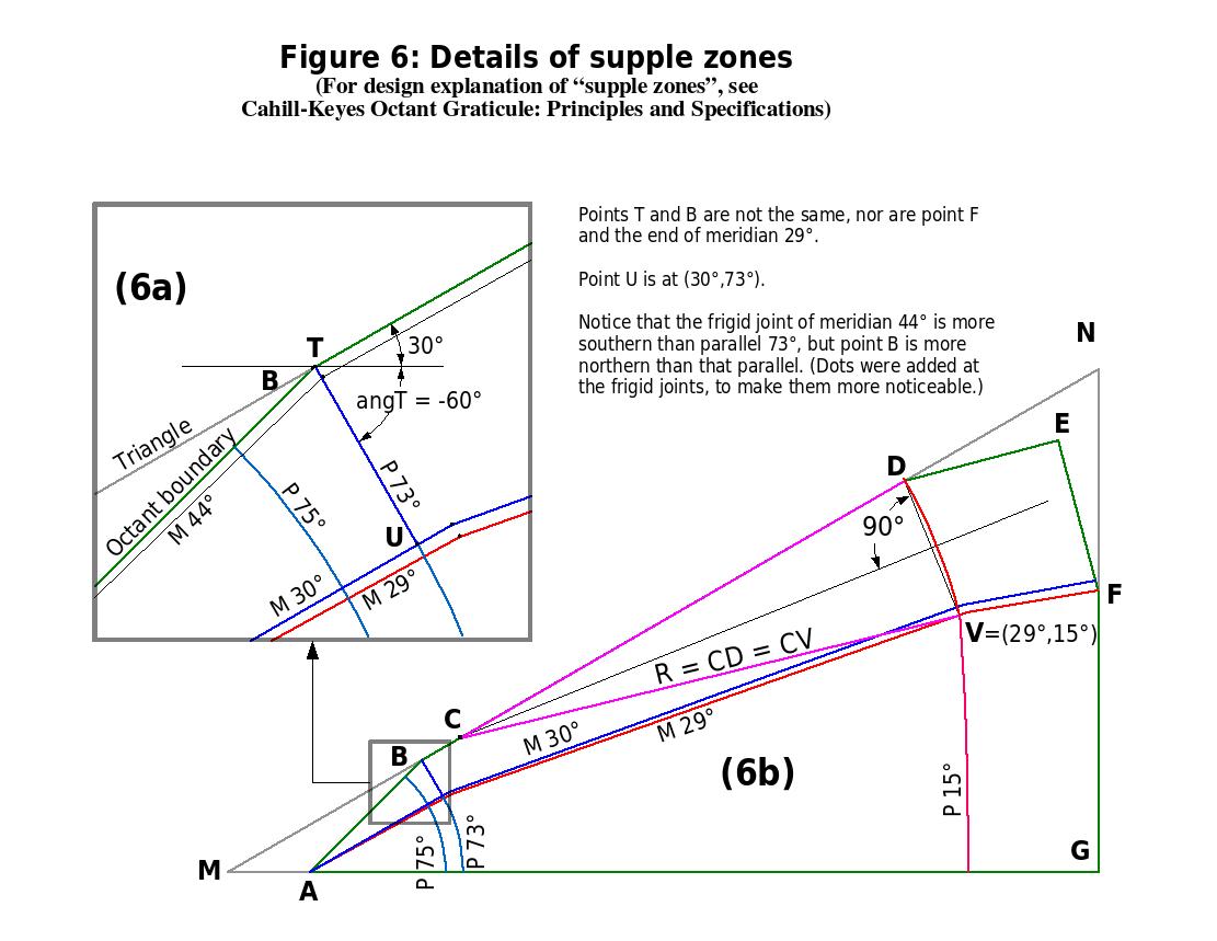
Sub Parallel 73() — used by subs Preliminary() and MPtoXY() — refer to fig. 6a.
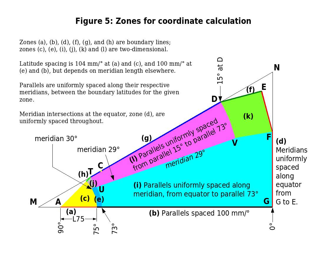
Sub MPtoXY() — the conversion
from meridian - parallel to x-y within the template half-octant, taking into
consideration the different zones of calculation — refer to figures 5 and 6.
Subs LineIntersetion(), Length(), Interpolate(), CircleLineIntersection() — just tools used by other subroutines.
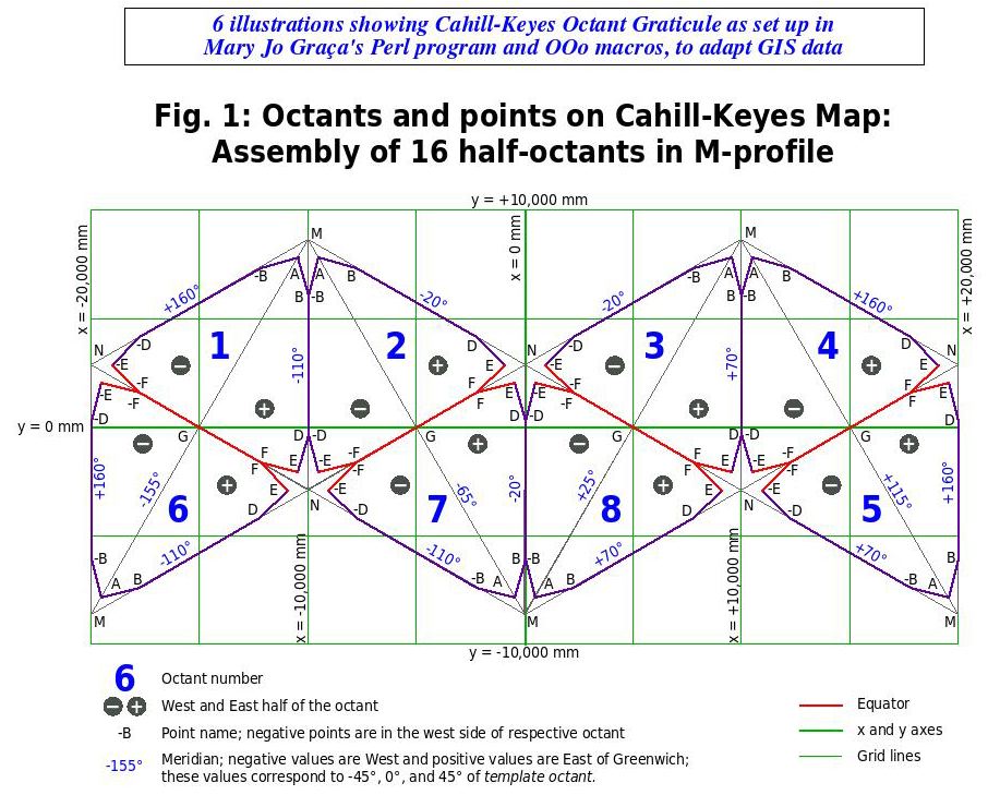
Sub LLtoMP() — converts world longitude - latitude to half-octant-template meridian - parallel — refer to fig. 1.
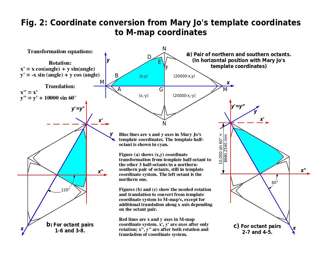
Sub MJtoG() and sub Rotate() — (the former sub uses the latter) convert from template to Cahill-Keyes coordinates — refer to figures 2 and 1.
The subroutines are not given in any particular
order. To convert world data from longitude - latitude to Cahill-Keyes world
map coordinates one would, after having called sub Preliminary() only once,
call the following three subroutines once for each datum: sub LLtoMP(), sub
MPtoXY() and sub MJtoG(). These subroutines call all the others.