| Go to Gene Keyes home page | |
| Go to complete linklist of Cahill-Keyes map development | |
 |
 |
|
Cahill 1909
|
Cahill-Keyes 1975 |
| Go to Gene Keyes home page | |
| Go to complete linklist of Cahill-Keyes map development | |
|
|
|
|
Cahill 1909
|
Cahill-Keyes 1975 |
|
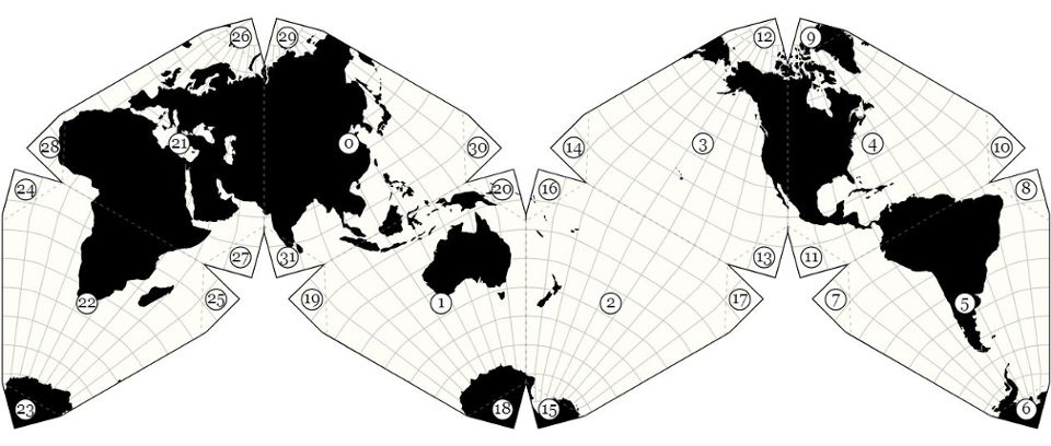
Cahill-Keyes World Map by Others, Part 2
A gallery of 14 different versions:
published, and drafts in progress 2020-01-18 |
|
Here is a sequel to the first set of 9 various renditions of the Cahill-Keyes World Map. Except for #8 below, I believe these are all D3's. I have tweaked their size or appearance to have a uniform set of comparisons across the frames.
The images are each resized to ca. 35 cm long (14"), ca. 1:115 million, more or less, depending on your monitor's size and resolution. (I selected a setting of 960 pixels in a 965 pixel frame, so as to show the entire world span on a 15" screen.) Until I make a slide show, you may want to open each world map in a separate tab, then click from one to the next to appreciate their variations at a glance. (Item #10 shows a detail close-up of the Denmark area at ca. 1/10 M.) |
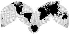
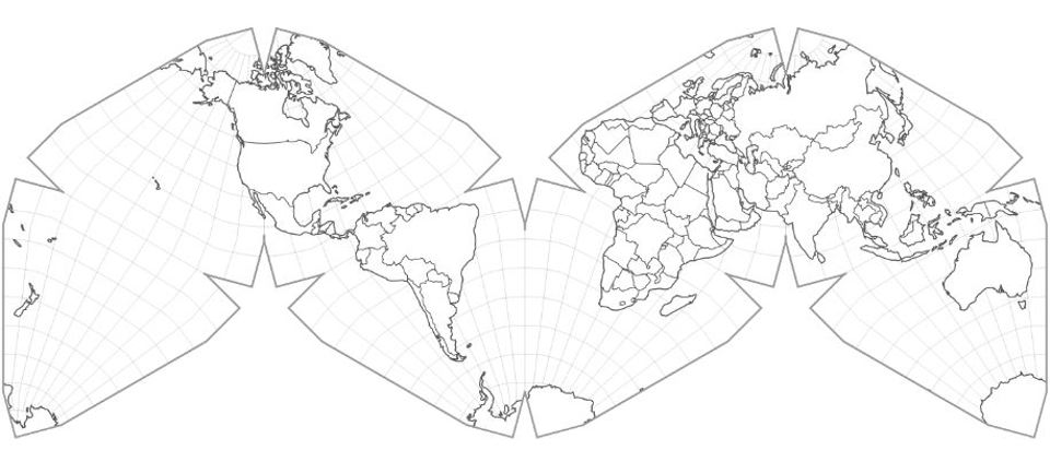
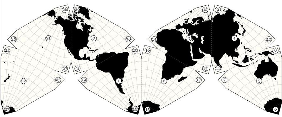
| 1) Philippe Rivière
Cahill-Keyes, D3, black continental silhouette version with 10º graticule.
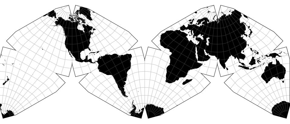 |
| 2) Philippe Rivière
Cahill-Keyes, D3, white outline version with national borders and 10º graticule.
  |
| 3) Philippe Rivière
GK note: This image is the same as the above, but inadvertently rendered with a black
background and white graticule in my old Mac OS 9 [Big Picture]; go figure. I think it looks pretty good, as a variant; in fact more vivid than the original. 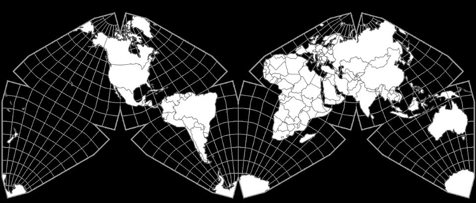 |
| 4) Kerkovits Krisztián
From a Hungarian website "Projection viewer" [English version]. Many projections to choose from (including Cahill-Keyes), and variables to enter. Note that "-20" (i.e., 20º W) must be put in the "Optimizer" for a correct division of the the C-K octants in the standard Atlantic profile. But for the Pacific version after this one, use 160 (i.e., 160º E).
 5) Kerkovits Krisztián GK note: The original website background is speckled grey, as in the first image;
for the Pacific version, my Mac OS 9 Goldberg image handler rendered the background in black, which I think looks much better.  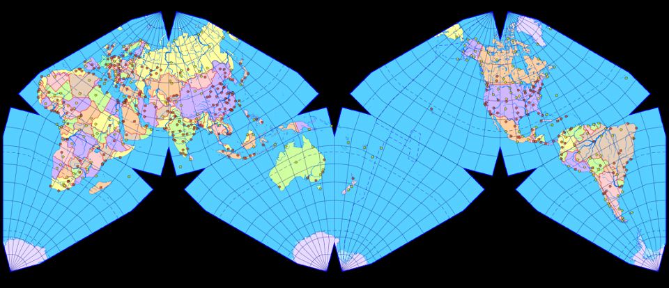 © Kerkovits Krisztián 2016–2018. Reproduction of the source code or the created images only with the permission of the author.
|
| 6) Philippe Rivière
Atlantic and Pacific versions:
 |
| 8) Tobias Jung GK: This non-D3 is a nice rendition of a
remote image Cahill-Keyes in a black background, with reunited Antarctica: a triple play! But the 15º geocells should all be 15º, rather than unevenly divided at the octant boundaries. 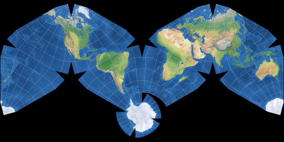 Cahill-Keyes Map Projection Image by Tobias Jung is licensed under a
Creative Commons Attribution-ShareAlike 4.0 International License. Image is based on Natural Earth II by Tom Patterson with darkened colors. Generated with G.Projector, Geocart or Flex Projector. https://blog.map-projections.net/four-polyhedral-projections (Click on his smaller white-background view for this larger one.) |
| 9) Philippe Rivière A different remote composite. Note: light blue background was inserted by GK with FastStone image handler;
other viewers had white or black background, each of which spoiled the octants, or Antarctica. 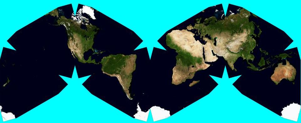
A small version of this image is shown on Rivière's web page http://visionscarto.net/paper-planets-and-how-to-make-them. At my request Philippe sent me the full size draft, 15,783 x 6,193 pixels, 15 MB, ca. 133 cm long (52"), whose scale I calculate to be ca. 1/30 M. I then reduced the map to fit in this frame. |
| 10) Philippe Rivière
Cahill-Keyes, Denmark area detail, ca. 1/10 M, with one-degree geocells.
Image tweaked by Gene Keyes, reducing original size from ca. 1/7 M, and increasing brightness, to highlight graticule. TBA: darken each fifth meridian and parallel. 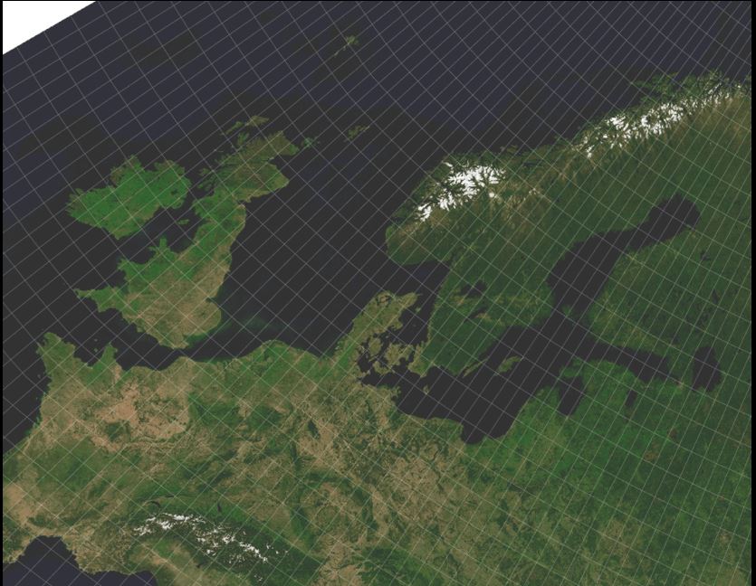 See my similar hand-drawn and computer-drawn outline versions of this area, 10x larger at 1/1 M, on http://www.genekeyes.com/MEGAMAP-BETA-1/Megamap-Beta-1.html
|
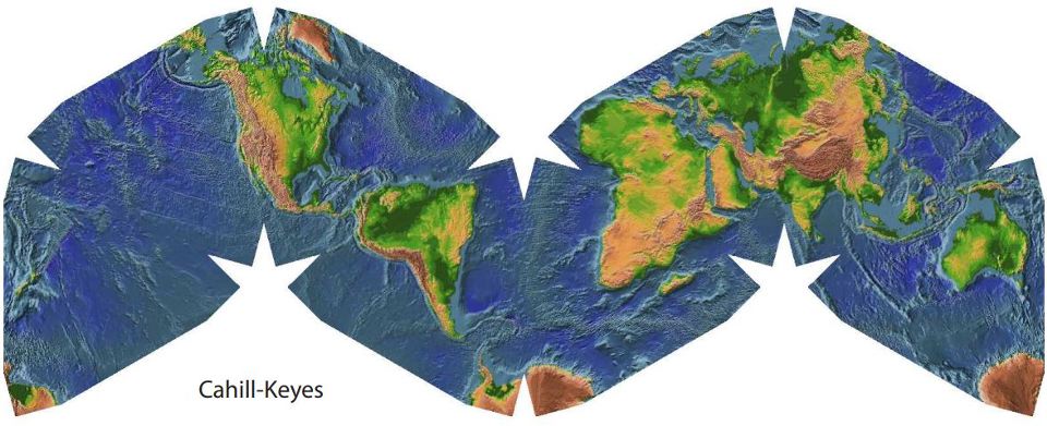
| 11) Philippe Rivière A Cahill-Keyes relief map, enlarged from image on http://visionscarto.net/paper-planets-and-how-to-make-them.
 |
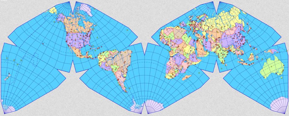
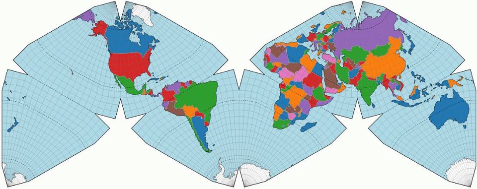
| 12) Enrico Spinielli The original Cahill-Keyes D3, in color with a 5º graticule (2013)
 |
| 13) Philippe Rivière In June 2019, Philippe Rivière was finally able to re-unite Antarctica into this D3 of a 10º Cahill-Keyes map.
His original has a white background, but my old Mac OS 9 image handler, Goldberg, makes it black. I like it that way. 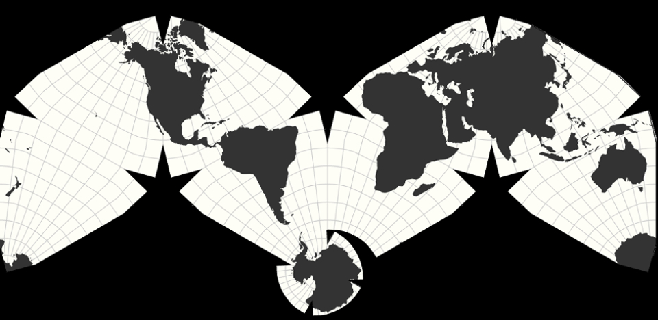 |
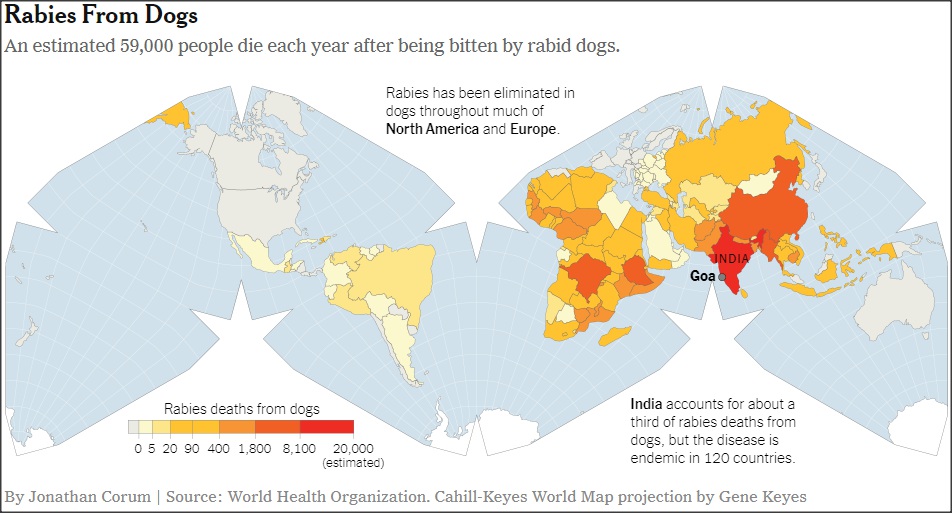
| 14) Jonathan Corum On 2019-07-22, The New York Times online (not print) edition published a long article by James Borman, "Rabies Kills Tens of Thousands Yearly. Vaccinating Dogs Could Stop It." Included was a Cahill-Keyes world map by Jonathan Corum, "Rabies deaths from dogs".
 |