ODT, biggest
|
B.J.S CAHILL'S BUTTERFLY MAP AND BEYOND: A COMPARATIVE GALLERY OF OCTAHEDRAL WORLD MAPS |
| Compiled by Gene
Keyes First edition, 2007-06-05 |
|
Thumb Index Each item opens in a separate window. If you have a tabbed browser, you can open some or all of the maps in separate tabs, then easily compare by toggling among them. |
|
N.B.: each map has been converted to a Comparison Scale of 1/200 M, either by enlarging
or reducing the source image. (To a span of 100 mm across the outer
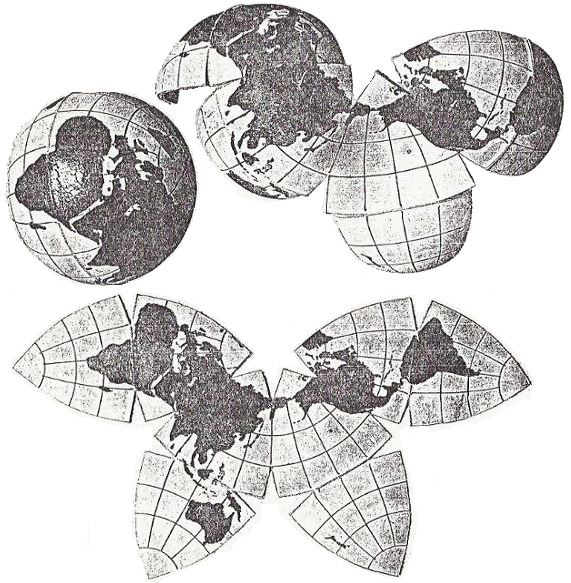
meridians of a 4-octant subset.) Geocell size is also specified. (In 1983, I coined the word "geocell" to designate a one-degree unit of latitude and longitude.) Each image here cites a "defining meridian", which enables unbroken continents if the octants follow from that given longitude. Cahill's master stroke was 22 1/2° W, but it resulted in geocell assymetry: too many half-degree units throughout. So 20° W is preferable for a Cahill-inspired map. Other division-longitudes miss the point, and break up continents, e.g., Harrison, and Anderson, below. Besides collecting scattered images of the Cahill map or derivatives, this gallery also indicates some sub-standard reproductions. Erroneous examples are marked "X": see notes within. This is not a complete listing; check back for updates. |
|
1909 Cahill Original |
1913 Cahill rubber ball globe~map |
1914 Cahill-Denoyer |
1919 Cahill |
1920 Cahill M-shape S. Pacific |
|
1934 Cahill 3-in-1 |
1934 Cahill M-shape |
1938 Raisz |
1944 Hood |
1962 Dahlberg X |
|
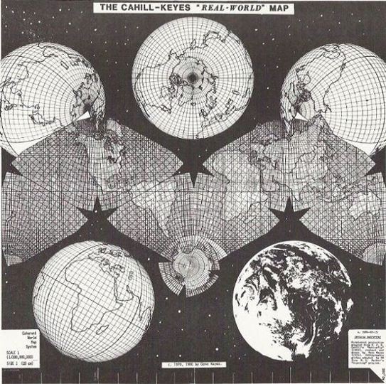
1975 Cahill-Keyes |
1975 Harrison X |
1976 Lee Conformal |
1996 Furuti Gnomonic |
1996 Furuti Gnomonic Truncated |
|
1996 Waterman |
1996 Waterman ODT, biggest |
2001 Furuti Gnomonic AVHRR |
2001 Furuti Gnomonic Remote |
2001 Furuti Gnomonic USGS |
|
2002 Anderson Conformal X |
2002 Anderson Gnomonic X |
2002 Anderson Equal-area X |
2006 Parry [Furuti] Gnomonic |
2007 Moore (Furuti) Gnomonic |