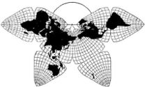
Cahill 1909
| Go to Gene Keyes home page | |
|
|
|
|
Cahill 1909
|
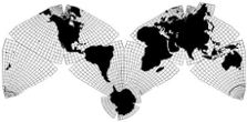
Cahill-Keyes 1975 |
|
Zooming to Crimea in the Cahill-Keyes Multi-Scale Megamap, Beta-2
Gene Keyes
2014-03-11 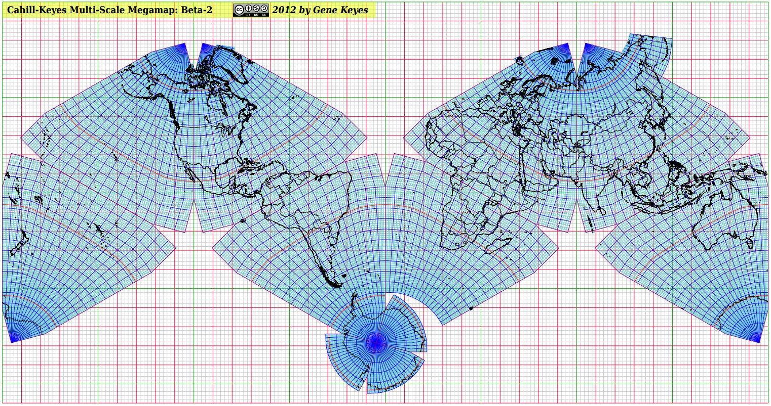 Above is a jpeg miniature, not the full-size Megamap pdf.
Note: this page supplements two earlier elaborations of the Beta-2. Here I only focus on how to use the free Foxit pdf reader to easily navigate the Megamap pdf at its humongous size of over 9,000 square feet. Even I, the map's designer, tended to get lost in transit when trying to roam the Megamap at its full original scale of 1/1 million. But the Foxit pdf reader solves that problem, and makes it a breeze to instantly relocate to any sector, zooming in and out, and panning smoothly in any chosen direction. (My previous discussion of Foxit was less detailed, and did not include screenshots, nor the importance of using "Fit Page" and "Marquee" in tandem.)The gleam in my eye has been a full-size hard copy in a gym or plaza, 40 m x 20 m (132' x 69'), but meanwhile you can easily view this free 35 MB pdf file at full size on your own PC, via the free Foxit pdf reader. Heretofore, the Megamap's original vector Draw file (odg) from Apache OpenOffice could vary the size and scale, but was much too slow and klutzy and crash-prone to be useful. Exporting the odg to a pdf file made for nice sharp printouts and more streamlined viewing. But Adobe's Acrobat is also too slow to be worthwhile after every move, it spends time re-drawing the entire map. The Chrome browser does a faster rendering, but spoils the image beyond 67%. However, I recently discovered that Foxit is far more flexible and faster than Adobe or Chrome; and can almost instantly portray the map at its full size, or smaller scales. Its panning function enables speedy dragging of the map to any region; its marquee function enables you to select and enlarge any given frame; and its "Zoom To" function lets you choose a large or small percent at which to see the map. Caveats: The smallest zooming-out size is 8.33%, which is still a big chunk of the map. However, the "Fit Page" size is 1%; see below. Also, the initial loading, and "Fit Page", each take about 10 seconds on my low-end Acer Windows 7 laptop. Every other move of the map is nearly instantaneous. |
|
Tips on using the Foxit pdf reader to navigate the Beta-2 Megamap
First, download the freeware Foxit. Then download the free Beta-2 Megamap pdf itself: Note: you should "save link as", and then open it with the Foxit pdf reader. If you merely click the link in a Chrome browser, it will open directly there at 10%, but can only enlarge to 67% before ruining the image. Other browsers may try to use Adobe as a helper app, which is no good. So be sure to "save link as", instead of directly clicking it.
The most important knack for scouting the full-size Megamap in Foxit pdf reader is first to use "Fit Page", then proceed to enlarge from there (and return to "Fit Page" whenever helpful).
The "Fit Page" command can be done in any of three ways:
These are Foxit's four most useful functions to maneuver the Megamap:
|
|
Note: Before opening the Megamap, but after launching Foxit for the first time, you should go to "Preferences" in the FILE tab at the far left, and do this:
|
Top left corner of 9,000 square-foot Cahill-Keyes Megamap Beta-2, seen at 100% in Foxit pdf reader. Note: each grey square in the Megamap represents 200 km. |
|
And when you try to pan or scroll at this point, you could soon get frustrated because of the huge distances involved. Therefore, you should go to "Fit Page", i.e., Ctrl 0, or the icon under "HOME", as explained above, and in 10 more seconds, you will see the entire world map, reduced to 1% of its actual size! (Preferably, you already opened it that way.) In "Fit Page" the map may be ca. 36 cm (or ca. 14") wide, plus or minus, depending on your screen size. Its new scale is 1/100 million; i.e., 100 times smaller than the full Megamap or its pdf.) That big yellow sign becomes a barely-visible speck at the top left corner. Remember that the Megamap is drawn at 1/1 million in high resolution to start with, then reduced by users' choices. It is not some smaller map blown up to that size.
Technical footnote: But at 1%, the map should in fact be 40 cm long, not 36 cm, as on my 17.3" laptop display. In general, at any scale, my Acer PC screen shows all these Megamap sizes at 9/10 of their "real" size (just as my 4 GB flash drives contain only 3.6 GB... ) I can live with that, as part of the fuzzy math of monitors. And I can also up the percent a little, as mentioned below. (When it comes to printing a pdf, however, the hard copy gets the size right. Screen display: not quite.) |
Cahill-Keyes Multi-Scale Megamap in Foxit pdf reader, reduced to 1% of its full size.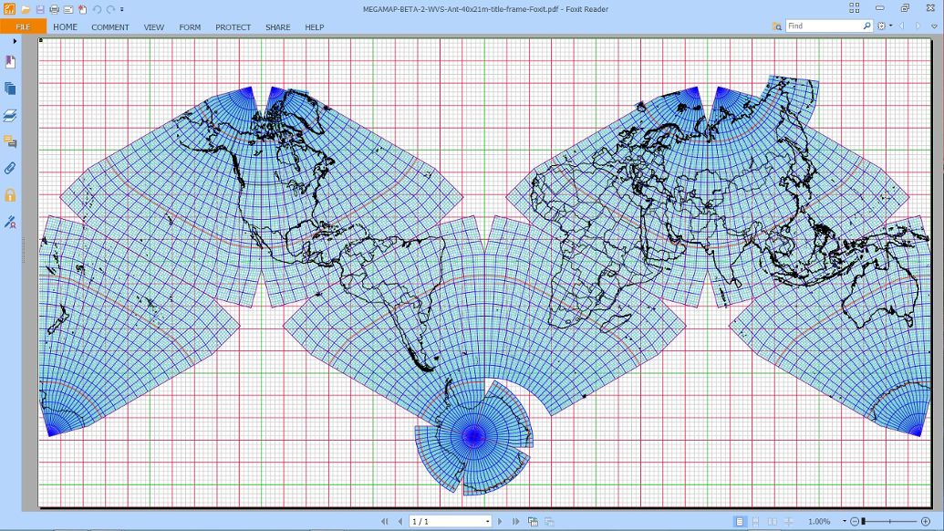 |
|
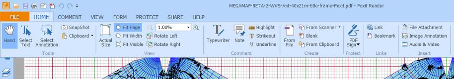
The partial screenshot below shows Foxit's HOME tab, open to show two of the most important icons for navigating the Megamap: "Hand" and "Fit Page". As well, "Zoom To" is activated by typing a percentage in the box near the center. (Click HOME again to hide all that, leaving more room for the map.)
Or, instead, you can use Ctrl 0 for "Fit Page", Alt 3 for "Hand", and Ctrl M for "Zoom To". |
 |
|
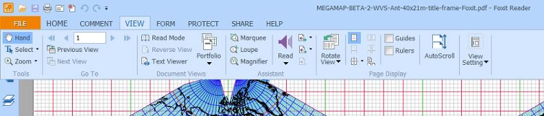
The other useful Foxit tab is VIEW, which has "Hand", again (at left), and the "Marquee" icon (at center) to select a part of the map for instant enlargement.
Or, instead, you can type Alt 5 for Marquee, and Alt 3 for Hand. (But remember to re-select "Hand" if you wish to pan after you have used "Marquee", or you will get another Marquee you didn't want.) |
 |
|
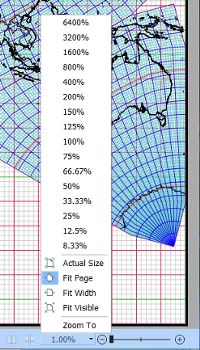
At the bottom left of the Foxit window is the status bar, showing whatever percentage the image is. Clicking its small arrow is another way to access the sizing commands. (One can also click those + or - symbols there, but they give irregular percentages. I prefer to choose my own "Zoom To" values, by clicking Ctrl M, and entering them..)
|
 |
|
In this example, I am going to use "Marquee" to zoom in on Crimea. After clicking Alt 5; a "+" sign inside a tiny magnifying glass will appear. Right click and hold the mouse button, then drag the "+" to make a frame from an upper to a lower corner of a small area inside the map: say, around Europe, enclosing the Black Sea, and Crimea. It will instantly enlarge to the map's "smallest" default size in Foxit, which is 8.33%. (I omit the whole-map image with the marquee, because the frame was not very conspicuous in the screen grab. Instead, below is the result.)
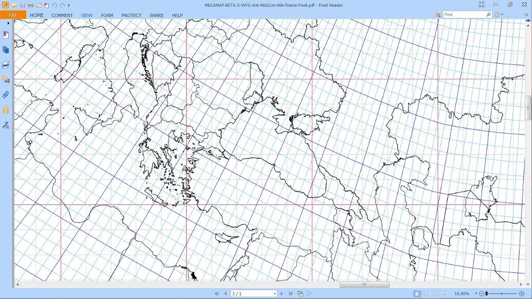
Voilà: the Black Sea and vicinity instantly appear. Foxit's default is 8.33%, but I preferred 10%, which would be as if an out-take from a large wall map of 1/10 million (4 m x 2 m, or 13' x 6.5'). So here I have also used "Zoom To" (Ctrl M), and then changed 8.33% to 10%. I also switched back to panning ("Hand", or Alt 3), to drag Crimea toward the center of the map.
Technical footnote: at 1/10 million, the red grid squares should be 10 cm long, but due to the fuzzy math I mentioned, they are only 9 cm long on my monitor. So if I really want to see the correct map scale and grid square size, I'd zoom to 11%, not 10%. I'm a stickler for getting scales right, but not knowing your monitor's size or resolution, I'll leave it at 10%, which in principle is the desired progression. |
 |
|
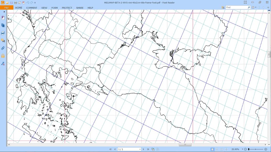
Coming closer, we "Zoom To" 20%, doubling the scale to 1/5 million. Notice percent readout at bottom left of all maps.
|
 |
|
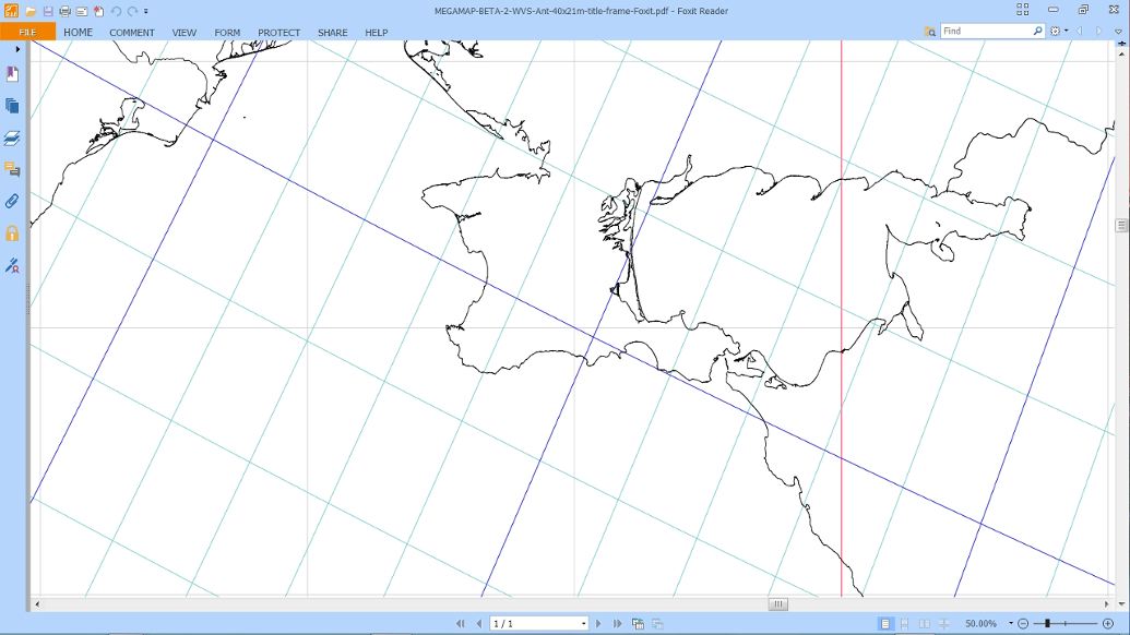
Closing in: we now "Zoom To" 50% , or 1/2 million, half the scale of the Megamap itself. Notice at every scale how the geocells (one degree of latitude and longitude) are all proportional to one another. This is one of the paramount design features of the Cahill-Keyes world map, not seen in any other single world map (not even Cahill's).
|
 |
|
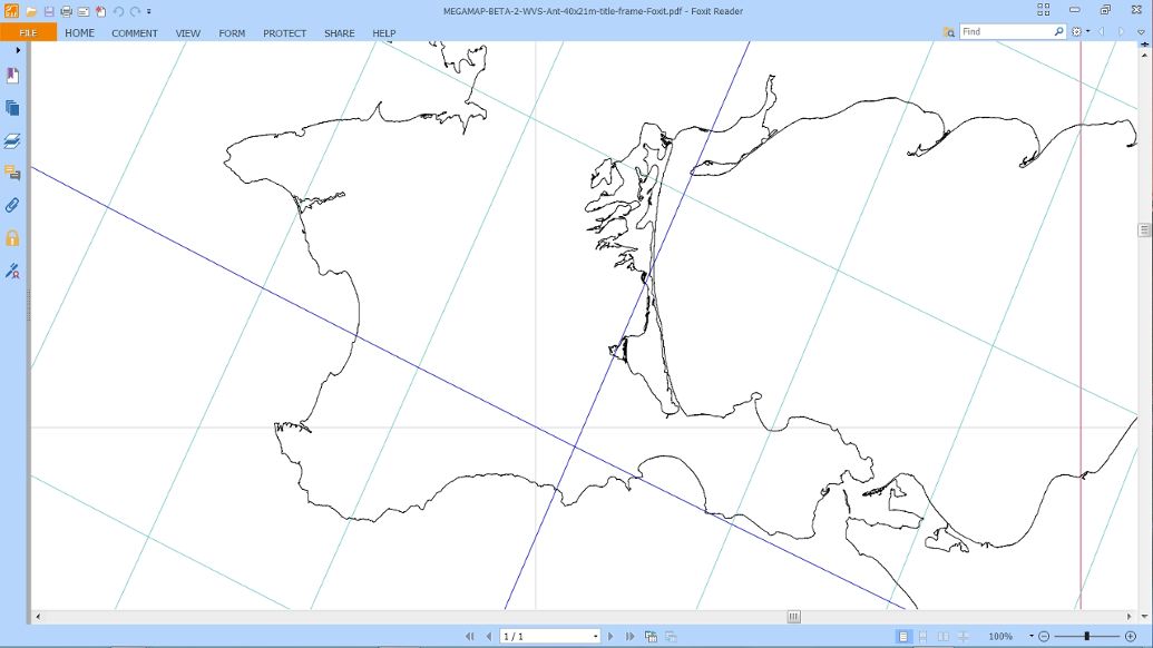
Finally, we "Zoom To" 100%: this is Crimea at the full scale of the Megamap, 1/1,000,000. From this point, one can safely pan around the vicinity without getting lost. Or, zoom out at Foxit's preset clicks ("-"), and take in greater areas. Or "Zoom To" whatever smaller percentage one chooses. Or go to "Fit Page", then Marquee another part of the earth, and close in.
|
 |
|
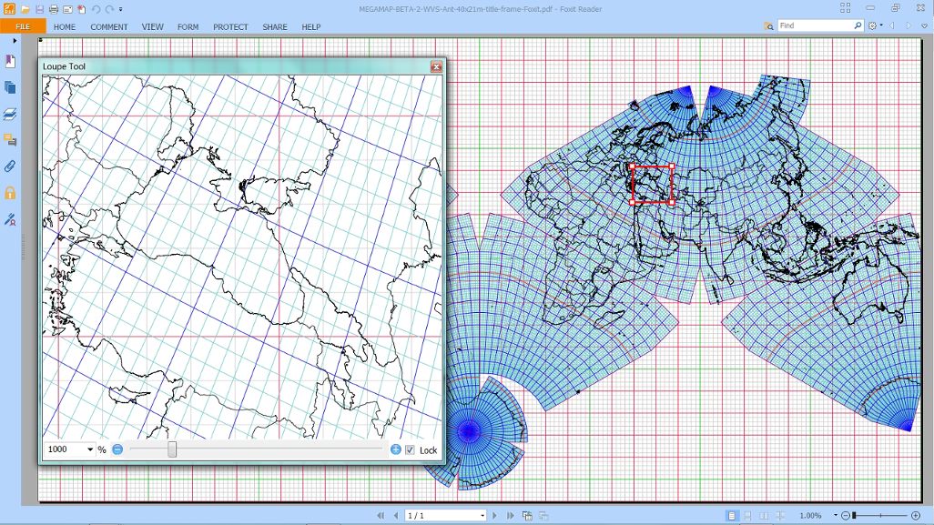
There is an alternate mechanism in Foxit called "Loupe", which provides an inset frame giving a variably enlarged view of the main map. Its icon is in the VIEW tab; no separate key combination. So far I have found it more complicated to use: not quite intuitive, and its percent numbers not in sync with the principle image. If the interface were improved, this could be a valuable additional way of traversing the Megamap.
|
 |
|
To summarize: With the Foxit pdf reader, a full-size, 9,000 square foot Megamap pdf can be easily navigated in its entire extent: enlarging from 1% to 100%, and panning at will: thereby demonstrating how the Cahill-Keyes Multi-scale Megamap is all the same map whatever its size, and how all its lands can be readily viewed at 1/1,000,000 showing their high-resolution coastlines and borders or at smaller scales. Cahill-Keyes is the world's only unitary world map, with good fidelity to a globe, always at a one-degree resolution, and with its geocells all proportional to one another.
|